ဖိုင်:Aerial photograph of Helmand River at Gereshk in 2011.jpg
ဤနမူနာ၏ အရွယ်အစား - ၈၀၀ × ၅၃၁ ပစ်ဇယ်။ အခြား ပုံရိပ်ပြတ်သားမှု: ၃၂၀ × ၂၁၂ ပစ်ဇယ် | ၆၄၀ × ၄၂၅ ပစ်ဇယ် | ၁၀၂၄ × ၆၈၀ ပစ်ဇယ် | ၁၂၈၀ × ၈၅၀ ပစ်ဇယ် | ၂၇၈၄ × ၁၈၄၈ ပစ်ဇယ်။
မူရင်းဖိုင် (၂၇၈၄ × ၁၈၄၈ pixels, ဖိုင်အရွယ်အစား - ၃.၉၅ MB, MIME အမျိုးအစား image/jpeg)
| ဤဖိုင်သည် Wikimedia Commons မှဖြစ်ပြီး အခြားပရောဂျက်များတွင် သုံးကောင်းသုံးလိမ့်မည်။ ယင်း၏ ဖိုင်အကြောင်းစာမျက်နှာ တွင် ဖော်ပြထားချက်ကို အောက်တွင် ပြထားသည်။ Commons သည် မူပိုင်ခွင့်လွတ်လပ်သော မီဒီယာဖိုင်များ သိုလှောင်ထားရာ နေရာ ဖြစ်သည်။ သင်လည်း ပါဝင်ကူညီနိုင်ပါသည်။ |
အကျဉ်းချုပ်
| ဖော်ပြချက် |
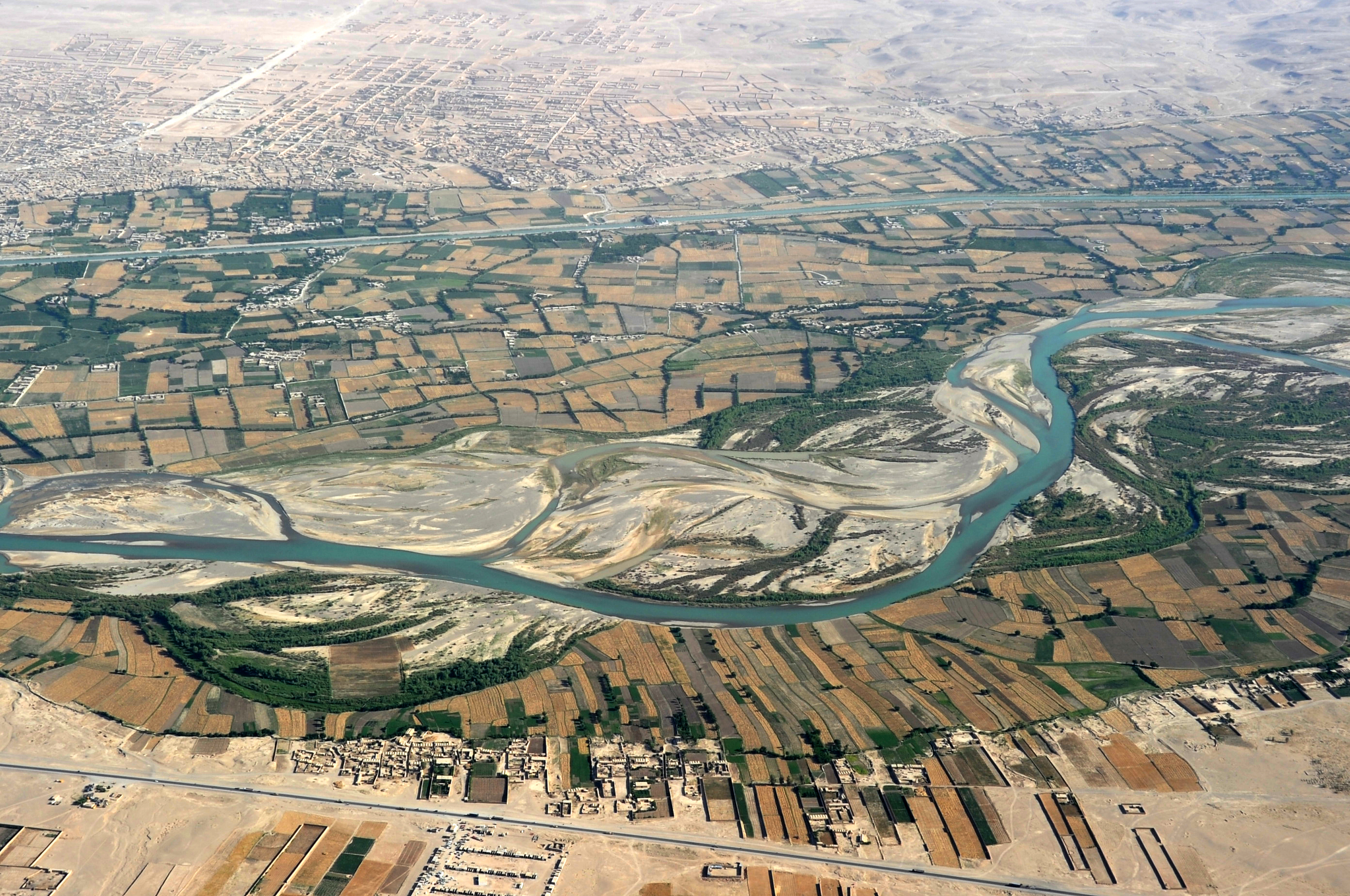
English: Traveling by helicopter enables us to see the beauty of Helmand River with the Boghra Irrigation Canal (Nahr-e Bughra) in the middle distance and the town of Gereshk (Grishk) in the far distance, Helmand Province. |
| ရက်စွဲ | |
| ရင်းမြစ် | https://www.flickr.com/photos/usace-tas/8713418682/in/photostream/ |
| စာရေးသူ | Karla Marshall |
| Camera location | | View this and other nearby images on: OpenStreetMap |
|---|
လိုင်စင်သတ်မှတ်ခြင်း
This image or file is a work of a U.S. Army Corps of Engineers soldier or employee, taken or made as part of that person's official duties. As a work of the U.S. federal government, the image is in the public domain.
|
ဖိုင်မှတ်တမ်း
ဖိုင်ကို ယင်းနေ့စွဲ အတိုင်း မြင်နိုင်ရန် နေ့စွဲ/အချိန် တစ်ခုခုပေါ်တွင် ကလစ်နှိပ်ပါ။
| နေ့စွဲ/အချိန် | နမူနာပုံငယ် | မှတ်တမ်း ဒိုင်မန်းရှင်းများ | အသုံးပြုသူ | မှတ်ချက် | |
|---|---|---|---|---|---|
| ကာလပေါ် | ၁၄:၁၄၊ ၂၁ မေ ၂၀၁၃ | | ၂၇၈၄ × ၁၈၄၈ (၃.၉၅ MB) | Officer | {{Information |Description={{en|Traveling by helicopter enables us to see the beauty of Kandahar province from the air. (USACE Photo by Karla Marshall)}} |Source=http://www.flickr.com/photos/usace-tas/8713418682/in/photostream/ |Date=2011-05-30 |Author... |
ဖိုင်သုံးစွဲမှု
အောက်ပါ စာမျက်နှာ သည် ဤဖိုင်ကို အသုံးပြုထားသည်:
ဂလိုဘယ် ဖိုင်သုံးစွဲမှု
အောက်ပါ အခြားဝီကီများတွင် ဤဖိုင်ကို အသုံးပြုထားသည်-
- ar.wikipedia.org တွင် အသုံးပြုမှု
- azb.wikipedia.org တွင် အသုံးပြုမှု
- bn.wikipedia.org တွင် အသုံးပြုမှု
- bs.wikipedia.org တွင် အသုံးပြုမှု
- ca.wikipedia.org တွင် အသုံးပြုမှု
- ceb.wikipedia.org တွင် အသုံးပြုမှု
- cs.wikipedia.org တွင် အသုံးပြုမှု
- cy.wikipedia.org တွင် အသုံးပြုမှု
- da.wikipedia.org တွင် အသုံးပြုမှု
- el.wikipedia.org တွင် အသုံးပြုမှု
- en.wikipedia.org တွင် အသုံးပြုမှု
- en.wikivoyage.org တွင် အသုံးပြုမှု
- en.wiktionary.org တွင် အသုံးပြုမှု
- eo.wikipedia.org တွင် အသုံးပြုမှု
- es.wikipedia.org တွင် အသုံးပြုမှု
- eu.wikipedia.org တွင် အသုံးပြုမှု
- fa.wikipedia.org တွင် အသုံးပြုမှု
- fi.wikipedia.org တွင် အသုံးပြုမှု
- fr.wikipedia.org တွင် အသုံးပြုမှု
- gu.wikipedia.org တွင် အသုံးပြုမှု
- he.wikipedia.org တွင် အသုံးပြုမှု
- hu.wikipedia.org တွင် အသုံးပြုမှု
- hy.wikipedia.org တွင် အသုံးပြုမှု
- id.wikipedia.org တွင် အသုံးပြုမှု
- incubator.wikimedia.org တွင် အသုံးပြုမှု
- it.wikipedia.org တွင် အသုံးပြုမှု
- kab.wikipedia.org တွင် အသုံးပြုမှု
- ka.wikipedia.org တွင် အသုံးပြုမှု
- kk.wikipedia.org တွင် အသုံးပြုမှု
ဤဖိုင်ကို အခြားနေရာများတွင် အသုံးပြုထားမှုများအား ကြည့်ရှုရန်။