ဖိုင်:Canada location map.svg

Size of this PNG preview of this SVG file: ၇၀၆ × ၅၉၉ ပစ်ဇယ်. အခြား ပုံရိပ်ပြတ်သားမှု: ၂၈၃ × ၂၄၀ ပစ်ဇယ် | ၅၆၆ × ၄၈၀ ပစ်ဇယ် | ၉၀၅ × ၇၆၈ ပစ်ဇယ် | ၁၂၀၇ × ၁၀၂၄ ပစ်ဇယ် | ၂၄၁၃ × ၂၀၄၈ ပစ်ဇယ် | ၁၀၈၄ × ၉၂၀ ပစ်ဇယ်။
မူရင်းဖိုင် (SVG ဖိုင်, ၁၀၈၄ × ၉၂၀ pixels ကို အကြံပြုသည်, ဖိုင်အရွယ်အစား - ၁၅၅ KB)
| ဤဖိုင်သည် Wikimedia Commons မှဖြစ်ပြီး အခြားပရောဂျက်များတွင် သုံးကောင်းသုံးလိမ့်မည်။ ယင်း၏ ဖိုင်အကြောင်းစာမျက်နှာ တွင် ဖော်ပြထားချက်ကို အောက်တွင် ပြထားသည်။ Commons သည် မူပိုင်ခွင့်လွတ်လပ်သော မီဒီယာဖိုင်များ သိုလှောင်ထားရာ နေရာ ဖြစ်သည်။ သင်လည်း ပါဝင်ကူညီနိုင်ပါသည်။ |
အကျဉ်းချုပ်
| ဖော်ပြချက် |
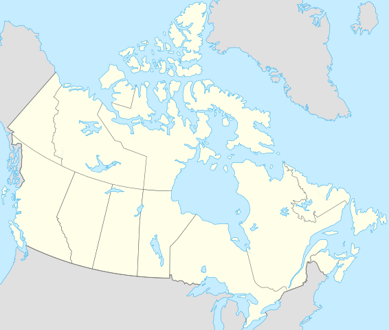
Français : Version recadrée et épurée de Carte administrative du Canada.svg pour la géolocation du Canada. Le cadrage est x=80px, y=166px, height=920, width=1084. Quelques positions :
English: cropped version of Carte administrative du Canada.svg for map location. |
|||||||||||||||||||||
| ရက်စွဲ | ||||||||||||||||||||||
| ရင်းမြစ် | Canada (geolocalisation).svg by STyx | |||||||||||||||||||||
| စာရေးသူ | Yug | |||||||||||||||||||||
| အခြား ဗားရှင်းများ |
Derivative works of this file: |
|||||||||||||||||||||
| SVG genesis |
|


.svg)
.svg)
}}
ကျွန်ုပ်၊ ဤလုပ်ဆောင်ချက်၏ မူပိုင်ခွင့်ပိုင်ရှင်အနေဖြင့် ဤနေရာမှ အောက်ပါလိုင်စင်များအောက်တွင် ထုတ်လွှင့်ပါသည်:
ဤဖိုင်သည် Creative Commons Attribution-Share Alike 2.5 Generic, 2.0 Generic and 1.0 Generic လိုင်စင်အောက်တွင် လိုင်စင်သတ်မှတ်ထားပါသည်။
- သင်သည် လွတ်လပ်စွာ:
- မျှဝေရန် – ဖန်တီးမှုကို ကူးယူရန်၊ ဖြန့်ဖြူးရန်နှင့် ထုတ်လွှင့်ရန်
- ပြန်ရောနှောရန် – ဖန်တီးမှုကို ပြင်ဆင်ညှိနှိုင်းရန်
- အောက်ပါ အခြေအနေများတွင်:
- မှတ်ယူနိုင်ခြင်း – ပြောင်းလဲမှုများ ပြုလုပ်ခဲ့ပါက ဖန်တီးသူ သို့မဟုတ် လိုင်စင်ရှိသူမှ သတ်မှတ်သော အမျိုးအစားကို လိုက်နာရမည် (ဆိုလိုသည်မှာ သင့်အား သို့မဟုတ် သင့်ဖန်တီးမှုတွင် အသုံးပြုခြင်းအား ထောက်ခံချက်ပေးသည်ဟု မဆိုလိုပါ)။
- ထပ်တူမျှဝေ – ဤဖန်တီးမှုအား ပြင်ဆင်ခြင်း၊ ပြောင်းလဲခြင်း သို့မဟုတ် ထပ်ဆင့် ဖန်တီးခြင်း ပြုလုပ်ပါက ရရှိလာသော ဖန်တီးမှုကို ဤဖန်တီးမှုနှင့် သို့မဟုတ် ဆင်တူသော လိုင်စင်ဖြင့်သာ ဖြန့်ချိသင့်သည်။

|
ဤစာတမ်းကို GNU Free Documentation License, ဗားရှင်း ၁.၂ သို့မဟုတ် Free Software Foundation မှ ဖြန့်ချီထားသော မည်သည့်ယခင်ဗားရှင်းတစ်ခုခုအောက်တွင် Invariant Sections, Front-Cover Texts နှင့် Back-Cover Texts များမပါဝင်ဘဲ ကူးယူခြင်း၊ ဖြန့်ချီခြင်း နှင့်/သို့မဟုတ် ပြင်ဆင်ပြောင်းလဲနိုင်ရန် ခွင့်ပြုသည်။ လိုင်စင်မူပွားကို GNU Free Documentation License ခေါင်းစဉ်အောက်တွင် ထည့်သွင်းထားသည်။ |
| ဤဖိုင်ကို Creative Commons Attribution-Share Alike 3.0 Unported လိုင်စင်ဖြင့် သတ်မှတ်ထားသည်။ | ||
| ||
| This licensing tag was added to this file as part of the GFDL licensing update. |
သင်အလိုရှိရာ လိုင်စင်ကို ရွေးချယ်နိုင်ပါသည်။
မူရင်းတင်ထားသောမှတ်တမ်း
This image is a derivative work of the following images:
- Canada (geolocalisation).svg licensed with Cc-by-sa-2.5,2.0,1.0, GFDL
- 2007-02-07T01:48:11Z STyx 1084x920 (95884 Bytes) retouche mineure
- 2007-02-07T01:41:09Z STyx 1084x920 (95939 Bytes) {{Information |Description= *{{fr}} Version recadrée et épurée de [[:Image:Carte administrative du Canada.svg]] pour la géolocation du Canada. Le cadrage est x=80px, y=166px, height=920, width=10
Uploaded with derivativeFX
ဖိုင်မှတ်တမ်း
ဖိုင်ကို ယင်းနေ့စွဲ အတိုင်း မြင်နိုင်ရန် နေ့စွဲ/အချိန် တစ်ခုခုပေါ်တွင် ကလစ်နှိပ်ပါ။
| နေ့စွဲ/အချိန် | နမူနာပုံငယ် | မှတ်တမ်း ဒိုင်မန်းရှင်းများ | အသုံးပြုသူ | မှတ်ချက် | |
|---|---|---|---|---|---|
| ကာလပေါ် | ၁၉:၂၇၊ ၁၇ ဧပြီ ၂၀၂၁ | | ၁၀၈၄ × ၉၂၀ (၁၅၅ KB) | Akeosnhaoe | draw in w:Killiniq Island as part of Nunavut and fix Smallwood Reservoir color |
| ၁၈:၂၄၊ ၁၆ ဧပြီ ၂၀၂၁ |  | ၁၀၈၄ × ၉၂၀ (၁၅၅ KB) | Akeosnhaoe | recreate previous 2 edits from the original to fix some borders on the water not being blue | |
| ၁၆:၁၃၊ ၂၆ ဇန်နဝါရီ ၂၀၁၄ |  | ၁၀၈၄ × ၉၂၀ (၆၇ KB) | Ras67 | -frame | |
| ၂၂:၅၃၊ ၁၈ ဇူလိုင် ၂၀၀၈ |  | ၁၀၈၄ × ၉၂၀ (၁၁၃ KB) | Yug | {{Information |Description= |Source= |Date= |Author= |Permission= |other_versions= }} | |
| ၂၂:၁၈၊ ၁၇ ဇူလိုင် ၂၀၀၈ |  | ၁၀၈၄ × ၉၂၀ (၁၅၅ KB) | Yug | {{Information |Description=*{{fr}} Version recadrée et épurée de Image:Carte administrative du Canada.svg pour la géolocation du Canada. Le cadrage est x=80px, y=166px, height=920, width=1084. Quelques positions : <center><table style="border:1px |
ဖိုင်သုံးစွဲမှု
အောက်ပါ စာမျက်နှာ သည် ဤဖိုင်ကို အသုံးပြုထားသည်:
ဂလိုဘယ် ဖိုင်သုံးစွဲမှု
အောက်ပါ အခြားဝီကီများတွင် ဤဖိုင်ကို အသုံးပြုထားသည်-
- af.wikipedia.org တွင် အသုံးပြုမှု
- als.wikipedia.org တွင် အသုံးပြုမှု
- an.wikipedia.org တွင် အသုံးပြုမှု
- ar.wikipedia.org တွင် အသုံးပြုမှု
- arz.wikipedia.org တွင် အသုံးပြုမှု
- ast.wikipedia.org တွင် အသုံးပြုမှု
- Gran Premiu de Canadá de 2007
- Gran Premiu de Canadá de 2006
- Gran Premiu de Canadá de 2008
- Montes Rocosos
- Windsor (Ontario)
- Ontario
- Islla del Cabu Bretón
- Nueva Escocia
- Islla Valdés
- Alberta
- Nueva Brunswick
- Nunavut
- Islla Killiniq
- Aeropuertu de Powell River
- London (Ontario)
- Toronto
- York University
- Alert
ဤဖိုင်ကို အခြားနေရာများတွင် အသုံးပြုထားမှုများအား ကြည့်ရှုရန်။