ဖိုင်:China Anhui.svg

Size of this PNG preview of this SVG file: ၇၀၅ × ၅၉၉ ပစ်ဇယ်. အခြား ပုံရိပ်ပြတ်သားမှု: ၂၈၂ × ၂၄၀ ပစ်ဇယ် | ၅၆၅ × ၄၈၀ ပစ်ဇယ် | ၉၀၄ × ၇၆၈ ပစ်ဇယ် | ၁၂၀၅ × ၁၀၂၄ ပစ်ဇယ် | ၂၄၀၉ × ၂၀၄၈ ပစ်ဇယ် | ၁၀၀၀ × ၈၅၀ ပစ်ဇယ်။
မူရင်းဖိုင် (SVG ဖိုင်, ၁၀၀၀ × ၈၅၀ pixels ကို အကြံပြုသည်, ဖိုင်အရွယ်အစား - ၂၁၀ KB)
| ဤဖိုင်သည် Wikimedia Commons မှဖြစ်ပြီး အခြားပရောဂျက်များတွင် သုံးကောင်းသုံးလိမ့်မည်။ ယင်း၏ ဖိုင်အကြောင်းစာမျက်နှာ တွင် ဖော်ပြထားချက်ကို အောက်တွင် ပြထားသည်။ Commons သည် မူပိုင်ခွင့်လွတ်လပ်သော မီဒီယာဖိုင်များ သိုလှောင်ထားရာ နေရာ ဖြစ်သည်။ သင်လည်း ပါဝင်ကူညီနိုင်ပါသည်။ |
| ဖော်ပြချက် |
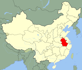
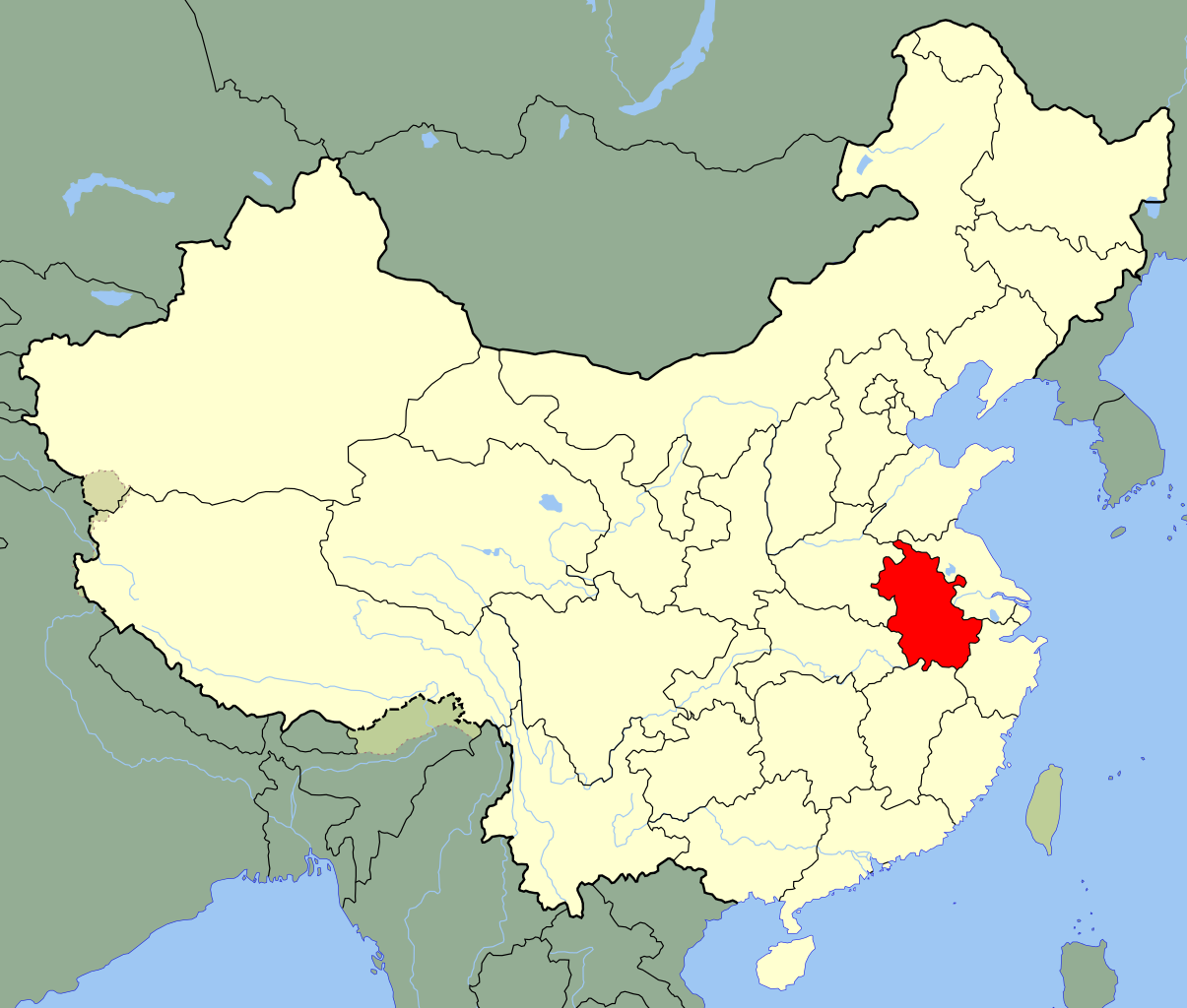
An SVG map of China with Anhui province highlighted Legend: |
||
| ရက်စွဲ | |||
| ရင်းမြစ် |
self-made; based on CIA public domain maps: |
||
| စာရေးသူ | Joowwww | ||
| ခွင့်ပြုချက် (ဤဖိုင်ကို ပြန်လည်အသုံးပြုခြင်း) |
|
||
| အခြား ဗားရှင်းများ |
|
ဖိုင်မှတ်တမ်း
ဖိုင်ကို ယင်းနေ့စွဲ အတိုင်း မြင်နိုင်ရန် နေ့စွဲ/အချိန် တစ်ခုခုပေါ်တွင် ကလစ်နှိပ်ပါ။
| နေ့စွဲ/အချိန် | နမူနာပုံငယ် | မှတ်တမ်း ဒိုင်မန်းရှင်းများ | အသုံးပြုသူ | မှတ်ချက် | |
|---|---|---|---|---|---|
| ကာလပေါ် | ၁၆:၁၁၊ ၁၃ ဩဂုတ် ၂၀၀၈ | | ၁၀၀၀ × ၈၅၀ (၂၁၀ KB) | Joowwww | added missing laos/vietnam border |
| ၁၁:၀၆၊ ၁၄ မေ ၂၀၀၈ |  | ၁၀၀၀ × ၈၅၀ (၂၀၈ KB) | Joowwww | {{Information |Description=An SVG map of China with Anhui province highlighted Legend:<br />Image:China map legend.png |Source=self-made; based on CIA public domain maps: *http://www.lib.utexas.edu/maps/middle_east_and_asia/china_admin_91.jpg *http:/ |
ဖိုင်သုံးစွဲမှု
အောက်ပါ စာမျက်နှာ သည် ဤဖိုင်ကို အသုံးပြုထားသည်:
ဂလိုဘယ် ဖိုင်သုံးစွဲမှု
အောက်ပါ အခြားဝီကီများတွင် ဤဖိုင်ကို အသုံးပြုထားသည်-
- ace.wikipedia.org တွင် အသုံးပြုမှု
- bg.wikipedia.org တွင် အသုံးပြုမှု
- bo.wikipedia.org တွင် အသုံးပြုမှု
- br.wikipedia.org တွင် အသုံးပြုမှု
- bs.wikipedia.org တွင် အသုံးပြုမှု
- ce.wikipedia.org တွင် အသုံးပြုမှု
- cs.wikipedia.org တွင် အသုံးပြုမှု
- en.wikipedia.org တွင် အသုံးပြုမှု
- eo.wikipedia.org တွင် အသုံးပြုမှု
- es.wikipedia.org တွင် အသုံးပြုမှု
- eu.wikipedia.org တွင် အသုံးပြုမှု
- fa.wikipedia.org တွင် အသုံးပြုမှု
- fi.wikipedia.org တွင် အသုံးပြုမှု
- fr.wikipedia.org တွင် အသုံးပြုမှု
ဤဖိုင်ကို အခြားနေရာများတွင် အသုံးပြုထားမှုများအား ကြည့်ရှုရန်။