ဖိုင်:Morocco relief location map.jpg

ဤနမူနာ၏ အရွယ်အစား - ၇၃၇ × ၆၀၀ ပစ်ဇယ်။ အခြား ပုံရိပ်ပြတ်သားမှု: ၂၉၅ × ၂၄၀ ပစ်ဇယ် | ၅၉၀ × ၄၈၀ ပစ်ဇယ် | ၉၄၄ × ၇၆၈ ပစ်ဇယ် | ၁၂၂၃ × ၉၉၅ ပစ်ဇယ်။
မူရင်းဖိုင် (၁၂၂၃ × ၉၉၅ pixels, ဖိုင်အရွယ်အစား - ၂၆၅ KB, MIME အမျိုးအစား image/jpeg)
| ဤဖိုင်သည် Wikimedia Commons မှဖြစ်ပြီး အခြားပရောဂျက်များတွင် သုံးကောင်းသုံးလိမ့်မည်။ ယင်း၏ ဖိုင်အကြောင်းစာမျက်နှာ တွင် ဖော်ပြထားချက်ကို အောက်တွင် ပြထားသည်။ Commons သည် မူပိုင်ခွင့်လွတ်လပ်သော မီဒီယာဖိုင်များ သိုလှောင်ထားရာ နေရာ ဖြစ်သည်။ သင်လည်း ပါဝင်ကူညီနိုင်ပါသည်။ |
အကျဉ်းချုပ်
| ဖော်ပြချက် |
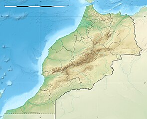
English: Blank physical map of Morocco, for geo-location purposes.
Français : Carte physique vierge du Maroc, destinée à la géolocalisation. Scale: 1:4,000,000 (precision: 1,000 m)
Geographic limits of the map:
|
||
| ရက်စွဲ | 2009-11, updated 2017-02 | ||
| ရင်းမြစ် |
ကိုယ်ပိုင်ဖန်တီးမှု
|
||
| စာရေးသူ | Eric Gaba (Sting - fr:Sting) | ||
| ခွင့်ပြုချက် (ဤဖိုင်ကို ပြန်လည်အသုံးပြုခြင်း) |
|
||
| အခြား ဗားရှင်းများ |
|

| Camera location | | View this and other nearby images on: OpenStreetMap |
|---|
လိုင်စင်သတ်မှတ်ခြင်း
ကျွန်ုပ်၊ ဤလုပ်ဆောင်ချက်၏ မူပိုင်ခွင့်ပိုင်ရှင်အနေဖြင့် ဤနေရာမှ အောက်ပါလိုင်စင်များအောက်တွင် ထုတ်လွှင့်ပါသည်:
ဤဖိုင်ကို Creative Commons Attribution-Share Alike 3.0 Unported လိုင်စင်ဖြင့် သတ်မှတ်ထားသည်။
- သင်သည် လွတ်လပ်စွာ:
- မျှဝေရန် – ဖန်တီးမှုကို ကူးယူရန်၊ ဖြန့်ဖြူးရန်နှင့် ထုတ်လွှင့်ရန်
- ပြန်ရောနှောရန် – ဖန်တီးမှုကို ပြင်ဆင်ညှိနှိုင်းရန်
- အောက်ပါ အခြေအနေများတွင်:
- မှတ်ယူနိုင်ခြင်း – ပြောင်းလဲမှုများ ပြုလုပ်ခဲ့ပါက ဖန်တီးသူ သို့မဟုတ် လိုင်စင်ရှိသူမှ သတ်မှတ်သော အမျိုးအစားကို လိုက်နာရမည် (ဆိုလိုသည်မှာ သင့်အား သို့မဟုတ် သင့်ဖန်တီးမှုတွင် အသုံးပြုခြင်းအား ထောက်ခံချက်ပေးသည်ဟု မဆိုလိုပါ)။
- ထပ်တူမျှဝေ – ဤဖန်တီးမှုအား ပြင်ဆင်ခြင်း၊ ပြောင်းလဲခြင်း သို့မဟုတ် ထပ်ဆင့် ဖန်တီးခြင်း ပြုလုပ်ပါက ရရှိလာသော ဖန်တီးမှုကို ဤဖန်တီးမှုနှင့် သို့မဟုတ် ဆင်တူသော လိုင်စင်ဖြင့်သာ ဖြန့်ချိသင့်သည်။

|
ဤစာတမ်းကို GNU Free Documentation License, ဗားရှင်း ၁.၂ သို့မဟုတ် Free Software Foundation မှ ဖြန့်ချီထားသော မည်သည့်ယခင်ဗားရှင်းတစ်ခုခုအောက်တွင် Invariant Sections, Front-Cover Texts နှင့် Back-Cover Texts များမပါဝင်ဘဲ ကူးယူခြင်း၊ ဖြန့်ချီခြင်း နှင့်/သို့မဟုတ် ပြင်ဆင်ပြောင်းလဲနိုင်ရန် ခွင့်ပြုသည်။ လိုင်စင်မူပွားကို GNU Free Documentation License ခေါင်းစဉ်အောက်တွင် ထည့်သွင်းထားသည်။ |
သင်အလိုရှိရာ လိုင်စင်ကို ရွေးချယ်နိုင်ပါသည်။
ဖိုင်မှတ်တမ်း
ဖိုင်ကို ယင်းနေ့စွဲ အတိုင်း မြင်နိုင်ရန် နေ့စွဲ/အချိန် တစ်ခုခုပေါ်တွင် ကလစ်နှိပ်ပါ။
| နေ့စွဲ/အချိန် | နမူနာပုံငယ် | မှတ်တမ်း ဒိုင်မန်းရှင်းများ | အသုံးပြုသူ | မှတ်ချက် | |
|---|---|---|---|---|---|
| ကာလပေါ် | ၂၀:၅၅၊ ၁၀ ဖေဖော်ဝါရီ ၂၀၁၇ | | ၁၂၂၃ × ၉၉၅ (၂၆၅ KB) | Sting | Updated regions borders as since 2015 |
| ၁၃:၁၁၊ ၁၉ ဇူလိုင် ၂၀၁၀ |  | ၁၂၂၃ × ၉၉၅ (၂၃၄ KB) | Sting | Color profile | |
| ၂၀:၃၁၊ ၂၁ နိုဝင်ဘာ ၂၀၀၉ |  | ၁၂၂၃ × ၉၉၅ (၂၄၀ KB) | Sting | Putting back the southern dotted boundary (regarding Western Sahara's location map) | |
| ၀၁:၂၃၊ ၂၁ နိုဝင်ဘာ ၂၀၀၉ |  | ၁၂၂၃ × ၉၉၅ (၂၃၉ KB) | Sting | Drawback for one "correction" | |
| ၀၁:၁၀၊ ၂၁ နိုဝင်ဘာ ၂၀၀၉ |  | ၁၂၂၃ × ၉၉၅ (၂၄၀ KB) | Sting | Several little corrections | |
| ၀၀:၀၉၊ ၂၁ နိုဝင်ဘာ ၂၀၀၉ |  | ၁၂၂၃ × ၉၉၅ (၂၄၁ KB) | Sting | == {{int:filedesc}} == {{Location|31|46|30|N|7|04|30|W|scale:5000000}} <br/> {{Information |Description={{en|Blank physical map of Morocco, for geo-location purposes.}} {{fr|Carte physique vierge du Maroc, destinée à la gé |
ဖိုင်သုံးစွဲမှု
အောက်ပါ 2 စာမျက်နှာများ သည် ဤဖိုင်ကို အသုံးပြုထားသည်:
ဂလိုဘယ် ဖိုင်သုံးစွဲမှု
အောက်ပါ အခြားဝီကီများတွင် ဤဖိုင်ကို အသုံးပြုထားသည်-
- af.wikipedia.org တွင် အသုံးပြုမှု
- ar.wikipedia.org တွင် အသုံးပြုမှု
- ast.wikipedia.org တွင် အသုံးပြုမှု
- azb.wikipedia.org တွင် အသုံးပြုမှု
- az.wikipedia.org တွင် အသုံးပြုမှု
- ba.wikipedia.org တွင် အသုံးပြုမှု
- be.wikipedia.org တွင် အသုံးပြုမှု
- bg.wikipedia.org တွင် အသုံးပြုမှု
ဤဖိုင်ကို အခြားနေရာများတွင် အသုံးပြုထားမှုများအား ကြည့်ရှုရန်။