ဖိုင်:Map of the Association of Southeast Asian Nations.svg

Size of this PNG preview of this SVG file: ၈၀၀ × ၃၅၃ ပစ်ဇယ်. အခြား ပုံရိပ်ပြတ်သားမှု: ၃၂၀ × ၁၄၁ ပစ်ဇယ် | ၆၄၀ × ၂၈၃ ပစ်ဇယ် | ၁၀၂၄ × ၄၅၂ ပစ်ဇယ် | ၁၂၈၀ × ၅၆၅ ပစ်ဇယ် | ၂၅၆၀ × ၁၁၃၀ ပစ်ဇယ် | ၉၄၀ × ၄၁၅ ပစ်ဇယ်။
မူရင်းဖိုင် (SVG ဖိုင်, ၉၄၀ × ၄၁၅ pixels ကို အကြံပြုသည်, ဖိုင်အရွယ်အစား - ၁.၅၁ MB)
| ဤဖိုင်သည် Wikimedia Commons မှဖြစ်ပြီး အခြားပရောဂျက်များတွင် သုံးကောင်းသုံးလိမ့်မည်။ ယင်း၏ ဖိုင်အကြောင်းစာမျက်နှာ တွင် ဖော်ပြထားချက်ကို အောက်တွင် ပြထားသည်။ Commons သည် မူပိုင်ခွင့်လွတ်လပ်သော မီဒီယာဖိုင်များ သိုလှောင်ထားရာ နေရာ ဖြစ်သည်။ သင်လည်း ပါဝင်ကူညီနိုင်ပါသည်။ |
အကျဉ်းချုပ်
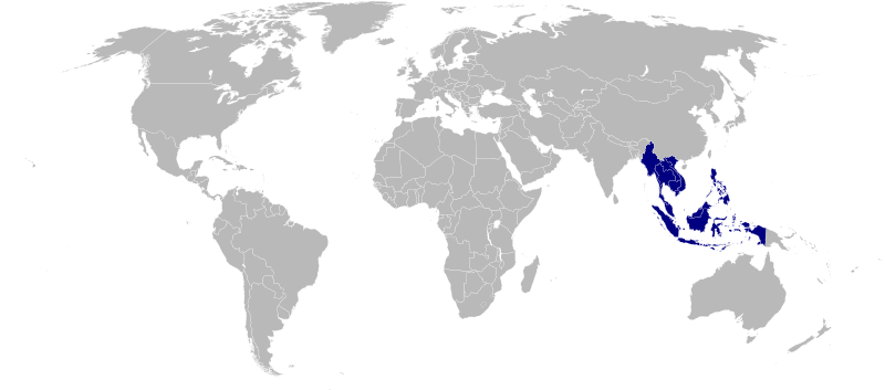
| ဖော်ပြချက် | Map of the Association of Southeast Asian Nations |
| ရင်းမြစ် | ကိုယ်ပိုင်ဖန်တီးမှု |
| စာရေးသူ | Mangwanani |
လိုင်စင်သတ်မှတ်ခြင်း
| I, the copyright holder of this work, release this work into the public domain. This applies worldwide. In some countries this may not be legally possible; if so: အကျွန်ုပ်သည် ဤဖန်တီးမှုလက်ရာကို ဥပဒေအရလိုအပ်ခြင်းမရှိသည့် မည်သည့်အခြေအနေမျိုးတွက်မဆို၊ မည်သို့သော ရည်ရွယ်ချက်အတွက်မဆို ၎င်းကို မည်သူမဆို အသုံးပြုပိုင်ခွင့်အား ပေးအပ်သည်။ |
ဖိုင်မှတ်တမ်း
ဖိုင်ကို ယင်းနေ့စွဲ အတိုင်း မြင်နိုင်ရန် နေ့စွဲ/အချိန် တစ်ခုခုပေါ်တွင် ကလစ်နှိပ်ပါ။
| နေ့စွဲ/အချိန် | နမူနာပုံငယ် | မှတ်တမ်း ဒိုင်မန်းရှင်းများ | အသုံးပြုသူ | မှတ်ချက် | |
|---|---|---|---|---|---|
| ကာလပေါ် | ၂၁:၄၈၊ ၂၀ ဩဂုတ် ၂၀၂၀ | | ၉၄၀ × ၄၁၅ (၁.၅၁ MB) | Hogweard | South Sudan border |
| ၁၆:၄၁၊ ၂၀ မေ ၂၀၀၈ |  | ၉၄၀ × ၄၁၅ (၁.၅ MB) | Mangwanani | fixed missing india... :S | |
| ၁၉:၀၁၊ ၂၇ ဧပြီ ၂၀၀၈ |  | ၉၄၀ × ၄၁၅ (၁.၅၆ MB) | Mangwanani | {{Information |Description= |Source= |Date= |Author= |Permission= |other_versions= }} | |
| ၁၈:၂၅၊ ၂၇ ဧပြီ ၂၀၀၈ |  | ၉၄၀ × ၄၁၅ (၁.၅၂ MB) | Mangwanani | add sg | |
| ၁၈:၂၀၊ ၂၇ ဧပြီ ၂၀၀၈ |  | ၉၄၀ × ၄၁၅ (၁.၅၂ MB) | Mangwanani | {{Information |Description=Map of the Association of Southeast Asian Nations |Source=self-made |Date= |Author= Mangwanani |Permission= |other_versions= }} |
ဖိုင်သုံးစွဲမှု
ဤဖိုင်ကို အသုံးပြုထားသော စာမျက်နှာများမရှိပါ။
ဂလိုဘယ် ဖိုင်သုံးစွဲမှု
အောက်ပါ အခြားဝီကီများတွင် ဤဖိုင်ကို အသုံးပြုထားသည်-
- ban.wikipedia.org တွင် အသုံးပြုမှု
- ba.wikipedia.org တွင် အသုံးပြုမှု
- en.wikipedia.org တွင် အသုံးပြုမှု
- es.wikipedia.org တွင် အသုံးပြုမှု
- fa.wikipedia.org တွင် အသုံးပြုမှု
- hu.wikipedia.org တွင် အသုံးပြုမှု
- hy.wikipedia.org တွင် အသုံးပြုမှု
- id.wikipedia.org တွင် အသုံးပြုမှု
- ja.wikipedia.org တွင် အသုံးပြုမှု
- ms.wikipedia.org တွင် အသုံးပြုမှု
- pl.wikipedia.org တွင် အသုံးပြုမှု
- ru.wikipedia.org တွင် အသုံးပြုမှု
- si.wikipedia.org တွင် အသုံးပြုမှု