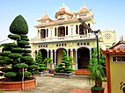
ကန်သို
Cần Thơ ၊ Can Tho သို့မဟုတ် Cantho ဟုရေးသားနိုင်သည်( standard Vietnamese : [kən˨˩ tʰəː˧˧] ၊ Southern : [kʌŋ˨˩ tʰəː] ) ကန်သိုမြို့ သည် ဗီယက်နမ်နိုင်ငံတွင် စတုတ္ထအကြီးဆုံးမြို့ဖြစ်ပြီး မဲခေါင်မြစ်ဝကျွန်းပေါ်ဒေသ တစ်လျှောက် အကြီးဆုံးမြို့လည်းဖြစ်သည်။
| Cần Thơ Thành phố Cần Thơ - Total | ||
|---|---|---|
| Municipality | ||
| Cần Thơ City | ||
| ||
| နာမည်ပြောင်(များ): "The capital of the West" (Tây Đô) | ||
 | ||
 | ||
| Country | ||
| Region | Mekong Delta | |
| Founded | 1789 | |
| Seat | Ninh Kiều | |
| Subdivision | 5 urban districts, 4 rural districts | |
| အစိုးရ | ||
| • အမျိုးအစား | Municipality (Class-1) | |
| • အစိုးရအဖွဲ့ | Cần Thơ People's Council | |
| • Secretary of the Party | Lê Quang Mạnh | |
| ဧရိယာ[၁] | ||
| • Municipality | ၁,၄၃၈.၉၆ စတုရန်းကီလိုမီတာ (၅၅၅.၅၉ စတုရန်းမိုင်) | |
| လူဦးရေ (2021)[၂] | ||
| • Municipality | ၁,၂၅၀,၇၉၂ | |
| • သိပ်သည်းမှု | ၈၇၀/km၂ (၂၃၀၀/sq mi) | |
| • မြို့ပေါ် | ၈၉၄,၅၀၀ | |
| Ethnic groups[၂] | ||
| • Vietnamese[၃] | {{{demographics1_info1}}} | |
| Postal code | 90xxxx | |
| Area codes | 292 | |
| ISO 3166 ကုဒ် | VN-CT | |
| ယာဉ်မှတ်ပုံတင် | 65 | |
| Climate | Aw | |
| International airports | Can Tho International Airport | |
| ဝက်ဘ်ဆိုဒ် | cantho.gov.vn | |
ကန်သိုမြို့သည် ၎င်း၏ရေပေါ်ဈေးများ ၊ ဆန်စက္ကူ ပြုလုပ်သည့်ကျေးရွာနှင့် လှပသေညကျေးလတ် တူးမြောင်း များကြောင့် ထင်ရှားနေပါသည်။ [၄] ကန်သိုမြို့သည် ၂၀၁၈ ခုနစ် သန်းခေါင်စာရင်းအရ [၅] လူဦးရေ ၁,၂၈၂,၃၀၀ ရှိပြီး မဲခေါင်မြစ် မှခွဲထွက်သည့် မြစ်တစ်စင်းဖြစ်သော ဟောင် မြစ် ၏ တောင်ဘက်ကမ်းတွင် တည်ရှိနေပါသည်။ ၂၀၀၇ ခုနစ်တွင် ကန်သို တံတား ပြိကျ မှုဖြစ်ပြီး ဗီယက်နမ်တွင် အဆိုင်းရွားဆုံး အင်ဂျင်နီယာဆိုင်ရာ ဘေးဥပဒ်ကြောင့် လူ 50 ခန့် သေဆုံးခဲ့သည်။ [၆] 2011 ခုနှစ်တွင် Cần Thơ အပြည်ပြည်ဆိုင်ရာလေဆိပ် ကို ဖွင့်လှစ်ခဲ့သည်။ [၇]
ကန်သိုမြို့သည် ဗီယက်နမ်၏ အနောက်ပိုင်းမြို့တော်လို့ အမည်တွင်ပြီး ( ဗီယက်နမ် ) က Tây Đô Hồ Chí Minh City မှ ၁၆၉ ကီလိုမီတာ(၁၀၅ မိုင်) အကွာတွင် တည်ရှိနေပါသည်။
ကန်သိုမြို့တော်သည် ဗီယက်နမ်၏ အခြားပြည်နယ်များ ကဲ့သို့ပင် သီးခြားလွတ်လပ်သော မြူနစ်စီပယ်တစ်ခုဖြစ်သည်။ ၂၀၀၄ ခုနစ်အစတွင် ကန်သိုပြည်နယ်ကို အုပ်ချုပ်ရေးယူနစ်အသစ် နှစ်ခုဖြစ်သော Cần Thơ City နှင့် Hậu Giang ခရိုင်ဟူ၍ ခွဲခြား ဖန်တီးခဲ့ကြသည်။
Cần Thơ ကို ခရိုင်အဆင့် ခရိုင်ခွဲ ၉ ခုခွဲထားသည်။
- ↑ "Phê duyệt và công bố kết quả thống kê diện tích đất đai của cả nước năm 2018" [Announcements of area statistics for the whole country in 2018]။ Act No. 2908/QĐ-BTNMT of (Vietnameseဘာသာစကားဖြင့်)။ Ministry of Natural Resources and Environment (Vietnam)။CS1 maint: အသိအမှတ်မပြုသော ဘာသာစကား (link) – the data in the report are in hectares, rounded to integers
- ↑ ၂.၀ ၂.၁ General Statistics Office of Vietnam (2019)။ "Completed Results of the 2019 Viet Nam Population and Housing Census" (PDF)။ Statistical Publishing House (Vietnam)။ ISBN 978-604-75-1532-5။
- ↑ Also called Kinh people
- ↑ Frommer's Vietnam: with Angkor Wat။ 7 February 2012။ 15 October 2012 တွင် ပြန်စစ်ပြီး။
- ↑ Statistical Yearbook of Vietnam 2018။ 2019။ p. 90။ 28 July 2020 တွင် မူရင်း အား မော်ကွန်းတင်ပြီး။ May 13, 2020 တွင် ပြန်စစ်ပြီး။
- ↑ Jessica Rowson (3 October 2007)။ 50 deaths in Can Tho bridge collapse။ New Civil Engineer။ EMAP Ltd။ 15 October 2012 တွင် ပြန်စစ်ပြီး။
- ↑ Emmons, p. 342.


