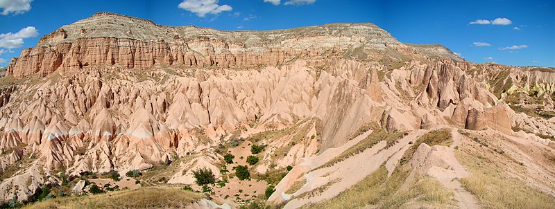
ဖိုင်:Cappadocia Aktepe Panorama.JPG

ဤနမူနာ၏ အရွယ်အစား - ၈၀၀ × ၃၀၂ ပစ်ဇယ်။ အခြား ပုံရိပ်ပြတ်သားမှု: ၃၂၀ × ၁၂၁ ပစ်ဇယ် | ၆၄၀ × ၂၄၁ ပစ်ဇယ် | ၁၀၂၄ × ၃၈၆ ပစ်ဇယ် | ၁၂၈၀ × ၄၈၃ ပစ်ဇယ် | ၂၅၆၀ × ၉၆၆ ပစ်ဇယ် | ၈၃၅၆ × ၃၁၅၂ ပစ်ဇယ်။
မူရင်းဖိုင် (၈၃၅၆ × ၃၁၅၂ pixels, ဖိုင်အရွယ်အစား - ၁၀.၈၃ MB, MIME အမျိုးအစား image/jpeg)
ဖိုင်မှတ်တမ်း
ဖိုင်ကို ယင်းနေ့စွဲ အတိုင်း မြင်နိုင်ရန် နေ့စွဲ/အချိန် တစ်ခုခုပေါ်တွင် ကလစ်နှိပ်ပါ။
| နေ့စွဲ/အချိန် | နမူနာပုံငယ် | မှတ်တမ်း ဒိုင်မန်းရှင်းများ | အသုံးပြုသူ | မှတ်ချက် | |
|---|---|---|---|---|---|
| ကာလပေါ် | ၁၂:၄၇၊ ၂၉ အောက်တိုဘာ ၂၀၀၉ | ၈၃၅၆ × ၃၁၅၂ (၁၀.၈၃ MB) | Uspn | {{Information |Description={{en|1=A panorama view of Aktepe Hill, a mountain north-east of Göreme in Cappadocia in Central Turkey. This area contains many ancient homes, churches, pigeon farms carved straight into the rock. This photo is taken in the Ros |
ဖိုင်သုံးစွဲမှု
အောက်ပါ စာမျက်နှာ သည် ဤဖိုင်ကို အသုံးပြုထားသည်:
ဂလိုဘယ် ဖိုင်သုံးစွဲမှု
အောက်ပါ အခြားဝီကီများတွင် ဤဖိုင်ကို အသုံးပြုထားသည်-
- af.wikipedia.org တွင် အသုံးပြုမှု
- ar.wikipedia.org တွင် အသုံးပြုမှု
- arz.wikipedia.org တွင် အသုံးပြုမှု
- azb.wikipedia.org တွင် အသုံးပြုမှု
- bs.wikipedia.org တွင် အသုံးပြုမှု
- el.wikipedia.org တွင် အသုံးပြုမှု
- en.wikipedia.org တွင် အသုံးပြုမှု
- es.wikipedia.org တွင် အသုံးပြုမှု
- hy.wikipedia.org တွင် အသုံးပြုမှု
- hyw.wikipedia.org တွင် အသုံးပြုမှု
- id.wikipedia.org တွင် အသုံးပြုမှု
- ka.wikipedia.org တွင် အသုံးပြုမှု
- ml.wikipedia.org တွင် အသုံးပြုမှု
- ms.wikipedia.org တွင် အသုံးပြုမှု
- nl.wikipedia.org တွင် အသုံးပြုမှု
- pl.wikivoyage.org တွင် အသုံးပြုမှု
- pnb.wikipedia.org တွင် အသုံးပြုမှု
- ro.wikipedia.org တွင် အသုံးပြုမှု
- ru.wikipedia.org တွင် အသုံးပြုမှု
- sl.wikipedia.org တွင် အသုံးပြုမှု
- th.wikipedia.org တွင် အသုံးပြုမှု
- tr.wikipedia.org တွင် အသုံးပြုမှု
- Kapadokya
- Göreme Tarihî Millî Parkı
- Vikipedi:Seçkin resimler/Mekânlar/Panorama
- Vikipedi:Seçkin resim adayları/Arşiv/Ocak 2010
- Vikipedi:Seçkin resim adayları/Cappadocia Aktepe Panorama.JPG
- Vikipedi:Günün seçkin resmi/Aralık 2011
- Şablon:GSR/2011-12-06
- Vikipedi:Seçkin resimler/Ana sayfaya çıkmış resimler/2011 listesi
- Vikipedi:Seçkin resimler/Ana sayfaya çıkmış resimler/2014 listesi
- Vikipedi:Günün seçkin resmi/Ekim 2014
- Şablon:GSR/2014-10-12
- Şablon:GSR/2017-05-13
- Vikipedi:Günün seçkin resmi/Mayıs 2017
- Kullanıcı:Berk Zorlutuna
- Vikipedi:Viki Yeryüzünü Seviyor/Liste
- Vikipedi:Günün seçkin resmi/Mart 2021
- Şablon:GSR/2021-03-12
- ug.wikipedia.org တွင် အသုံးပြုမှု
ဤဖိုင်ကို အခြားနေရာများတွင် အသုံးပြုထားမှုများအား ကြည့်ရှုရန်။
