ဖိုင်:Europe-Kosovo.svg

Size of this PNG preview of this SVG file: ၇၁၃ × ၅၉၉ ပစ်ဇယ်. အခြား ပုံရိပ်ပြတ်သားမှု: ၂၈၆ × ၂၄၀ ပစ်ဇယ် | ၅၇၁ × ၄၈၀ ပစ်ဇယ် | ၉၁၄ × ၇၆၈ ပစ်ဇယ် | ၁၂၁၈ × ၁၀၂၄ ပစ်ဇယ် | ၂၄၃၇ × ၂၀၄၈ ပစ်ဇယ် | ၂၁၈၂ × ၁၈၃၄ ပစ်ဇယ်။
မူရင်းဖိုင် (SVG ဖိုင်, ၂၁၈၂ × ၁၈၃၄ pixels ကို အကြံပြုသည်, ဖိုင်အရွယ်အစား - ၂.၁၂ MB)
| ဤဖိုင်သည် Wikimedia Commons မှဖြစ်ပြီး အခြားပရောဂျက်များတွင် သုံးကောင်းသုံးလိမ့်မည်။ ယင်း၏ ဖိုင်အကြောင်းစာမျက်နှာ တွင် ဖော်ပြထားချက်ကို အောက်တွင် ပြထားသည်။ Commons သည် မူပိုင်ခွင့်လွတ်လပ်သော မီဒီယာဖိုင်များ သိုလှောင်ထားရာ နေရာ ဖြစ်သည်။ သင်လည်း ပါဝင်ကူညီနိုင်ပါသည်။ |
အကျဉ်းချုပ်
| ဖော်ပြချက် |
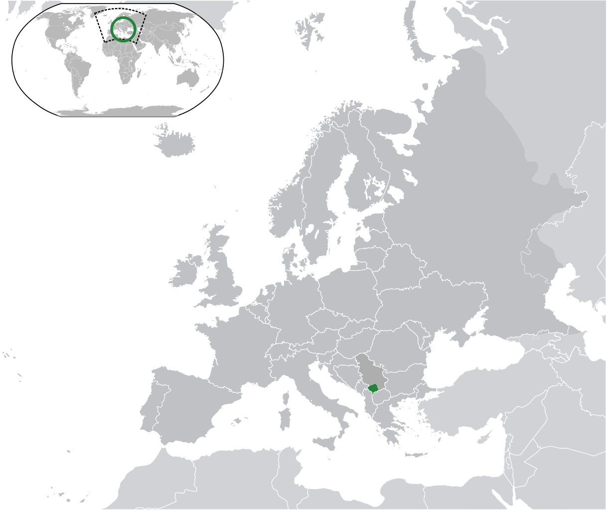
Kosovo, with marked a Serbian claim in another grey (claim) as the other European countries
Is not the same as Europe-Republic of Kosovo.svg, map without Serbian claim on Kosovo, Serbia has the same color as the other European countries Українська: Розташування Косова на мапі Європи |
||
| ရက်စွဲ | |||
| ရင်းမြစ် | ကိုယ်ပိုင်ဖန်တီးမှု | ||
| စာရေးသူ |
|
||
| ခွင့်ပြုချက် (ဤဖိုင်ကို ပြန်လည်အသုံးပြုခြင်း) |
|
||
| SVG genesis |

လိုင်စင်သတ်မှတ်ခြင်း
ဤဖိုင်ကို Creative Commons Attribution-Share Alike 3.0 Unported လိုင်စင်ဖြင့် သတ်မှတ်ထားသည်။
- သင်သည် လွတ်လပ်စွာ:
- မျှဝေရန် – ဖန်တီးမှုကို ကူးယူရန်၊ ဖြန့်ဖြူးရန်နှင့် ထုတ်လွှင့်ရန်
- ပြန်ရောနှောရန် – ဖန်တီးမှုကို ပြင်ဆင်ညှိနှိုင်းရန်
- အောက်ပါ အခြေအနေများတွင်:
- မှတ်ယူနိုင်ခြင်း – ပြောင်းလဲမှုများ ပြုလုပ်ခဲ့ပါက ဖန်တီးသူ သို့မဟုတ် လိုင်စင်ရှိသူမှ သတ်မှတ်သော အမျိုးအစားကို လိုက်နာရမည် (ဆိုလိုသည်မှာ သင့်အား သို့မဟုတ် သင့်ဖန်တီးမှုတွင် အသုံးပြုခြင်းအား ထောက်ခံချက်ပေးသည်ဟု မဆိုလိုပါ)။
- ထပ်တူမျှဝေ – ဤဖန်တီးမှုအား ပြင်ဆင်ခြင်း၊ ပြောင်းလဲခြင်း သို့မဟုတ် ထပ်ဆင့် ဖန်တီးခြင်း ပြုလုပ်ပါက ရရှိလာသော ဖန်တီးမှုကို ဤဖန်တီးမှုနှင့် သို့မဟုတ် ဆင်တူသော လိုင်စင်ဖြင့်သာ ဖြန့်ချိသင့်သည်။
ဖိုင်မှတ်တမ်း
ဖိုင်ကို ယင်းနေ့စွဲ အတိုင်း မြင်နိုင်ရန် နေ့စွဲ/အချိန် တစ်ခုခုပေါ်တွင် ကလစ်နှိပ်ပါ။
| နေ့စွဲ/အချိန် | နမူနာပုံငယ် | မှတ်တမ်း ဒိုင်မန်းရှင်းများ | အသုံးပြုသူ | မှတ်ချက် | |
|---|---|---|---|---|---|
| ကာလပေါ် | ၁၃:၅၁၊ ၁၇ ဒီဇင်ဘာ ၂၀၂၃ | | ၂၁၈၂ × ၁၈၃၄ (၂.၁၂ MB) | Iktsokh | Cyprus geographically in Asia |
| ၁၉:၁၁၊ ၁၂ ဒီဇင်ဘာ ၂၀၂၀ |  | ၂၁၈၂ × ၁၈၃၄ (၂.၁၂ MB) | Ahmet Q. | Reverted to version as of 22:34, 11 July 2020 (UTC) | |
| ၁၈:၅၃၊ ၂၇ အောက်တိုဘာ ၂၀၂၀ |  | ၂၁၈၂ × ၁၈၃၄ (၂.၁၃ MB) | Savasampion | bigger map | |
| ၂၂:၃၄၊ ၁၁ ဇူလိုင် ၂၀၂၀ |  | ၂၁၈၂ × ၁၈၃၄ (၂.၁၂ MB) | De728631 | Added South Sudan to World map | |
| ၁၁:၁၂၊ ၆ ဩဂုတ် ၂၀၁၄ |  | ၂၀၄၅ × ၁၇၂၀ (၂.၆၄ MB) | KronosLine | Reverted to version as of 03:44, 2 July 2013 | |
| ၁၅:၅၈၊ ၃၀ မေ ၂၀၁၄ |  | ၂၀၄၅ × ၁၇၂၀ (၂.၇ MB) | Rfc1394 | Add concentric circles around country to make it easier to see when thumbnails of this image are used | |
| ၀၃:၄၄၊ ၂ ဇူလိုင် ၂၀၁၃ |  | ၂၀၄၅ × ၁၇၂၀ (၂.၆၄ MB) | Chipmunkdavis | Reverted to version as of 11:53, 6 August 2012 Serbia is noted here due to the claim | |
| ၀၈:၁၇၊ ၁ ဇူလိုင် ၂၀၁၃ |  | ၂၀၄၅ × ၁၇၂၀ (၂.၇ MB) | Klodde | Same color | |
| ၁၁:၅၃၊ ၆ ဩဂုတ် ၂၀၁၂ |  | ၂၀၄၅ × ၁၇၂၀ (၂.၆၄ MB) | The Emirr | Update. | |
| ၁၆:၃၀၊ ၁၆ ဇွန် ၂၀၁၀ |  | ၂၀၄၅ × ၁၇၂၀ (၂.၇ MB) | The Emirr | {{Information |Description={{en|1={{Europe-SVG-en|Kosovo}}}} |Source={{own}} |Author={{click|image=TheEmirr-Logo.png|link=User:The Emirr|width=60px|height=60px}} |Date=2010-06-16 |Permission={{GFDL}} |other_versions= }} Category:Maps of Kosovo [[Cate |
ဖိုင်သုံးစွဲမှု
အောက်ပါ စာမျက်နှာ သည် ဤဖိုင်ကို အသုံးပြုထားသည်:
ဂလိုဘယ် ဖိုင်သုံးစွဲမှု
အောက်ပါ အခြားဝီကီများတွင် ဤဖိုင်ကို အသုံးပြုထားသည်-
- af.wikipedia.org တွင် အသုံးပြုမှု
- az.wikipedia.org တွင် အသုံးပြုမှု
- bn.wikipedia.org တွင် အသုံးပြုမှု
- ca.wikipedia.org တွင် အသုံးပြုမှု
- cs.wikipedia.org တွင် အသုံးပြုမှု
- en.wikipedia.org တွင် အသုံးပြုမှု
- es.wikipedia.org တွင် အသုံးပြုမှု
- fa.wikipedia.org တွင် အသုံးပြုမှု
- hi.wikipedia.org တွင် အသုံးပြုမှု
- it.wikipedia.org တွင် အသုံးပြုမှု
- km.wikipedia.org တွင် အသုံးပြုမှု
- mk.wikipedia.org တွင် အသုံးပြုမှု
- mn.wikipedia.org တွင် အသုံးပြုမှု
- no.wikipedia.org တွင် အသုံးပြုမှု
- pnb.wikipedia.org တွင် အသုံးပြုမှု
- pt.wikipedia.org တွင် အသုံးပြုမှု
- rm.wikipedia.org တွင် အသုံးပြုမှု
- simple.wikipedia.org တွင် အသုံးပြုမှု
- sr.wikipedia.org တွင် အသုံးပြုမှု
- ur.wikipedia.org တွင် အသုံးပြုမှု
- vec.wikipedia.org တွင် အသုံးပြုမှု
- yo.wikipedia.org တွင် အသုံးပြုမှု
- zh.wikipedia.org တွင် အသုံးပြုမှု