ဖိုင်:Gb4dot.svg

Size of this PNG preview of this SVG file: ၄၁၇ × ၅၉၉ ပစ်ဇယ်. အခြား ပုံရိပ်ပြတ်သားမှု: ၁၆၇ × ၂၄၀ ပစ်ဇယ် | ၃၃၄ × ၄၈၀ ပစ်ဇယ် | ၅၃၄ × ၇၆၈ ပစ်ဇယ် | ၇၁၃ × ၁၀၂၄ ပစ်ဇယ် | ၁၄၂၅ × ၂၀၄၈ ပစ်ဇယ် | ၁၁၀၄ × ၁၅၈၆ ပစ်ဇယ်။
မူရင်းဖိုင် (SVG ဖိုင်, ၁၁၀၄ × ၁၅၈၆ pixels ကို အကြံပြုသည်, ဖိုင်အရွယ်အစား - ၁၀၁၂ KB)
| ဤဖိုင်သည် Wikimedia Commons မှဖြစ်ပြီး အခြားပရောဂျက်များတွင် သုံးကောင်းသုံးလိမ့်မည်။ ယင်း၏ ဖိုင်အကြောင်းစာမျက်နှာ တွင် ဖော်ပြထားချက်ကို အောက်တွင် ပြထားသည်။ Commons သည် မူပိုင်ခွင့်လွတ်လပ်သော မီဒီယာဖိုင်များ သိုလှောင်ထားရာ နေရာ ဖြစ်သည်။ သင်လည်း ပါဝင်ကူညီနိုင်ပါသည်။ |
အကျဉ်းချုပ်
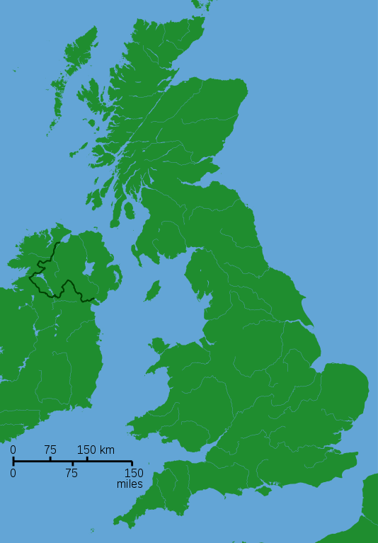
| ဖော်ပြချက် |
A blank locator map for Great Britain. The idea is to superimpose Image:dot4gb.svg at the appropriate point. See w:Template:GBthumb for code to do this. These two images can replace any locator map posted by Lupin - see w:Special:Contributions/LupinBot. This is a vectorized version of Image:Gb4dot.png, with the scale changed from 200 km to 150 km/150 miles. The shoreline data come from the file gshhs_h.b from the GSHHS, and the rivers and the Irish border come from the CIA World DataBank II; both sources are in the public domain. Mercator projection. |
| ရက်စွဲ | ၈ ဩဂုတ် ၂၀၀၆ (original upload date) |
| ရင်းမြစ် | No machine-readable source provided. Own work assumed (based on copyright claims). |
| စာရေးသူ | No machine-readable author provided. Wereon assumed (based on copyright claims). |
လိုင်စင်သတ်မှတ်ခြင်း
| I, the copyright holder of this work, release this work into the public domain. This applies worldwide. In some countries this may not be legally possible; if so: အကျွန်ုပ်သည် ဤဖန်တီးမှုလက်ရာကို ဥပဒေအရလိုအပ်ခြင်းမရှိသည့် မည်သည့်အခြေအနေမျိုးတွက်မဆို၊ မည်သို့သော ရည်ရွယ်ချက်အတွက်မဆို ၎င်းကို မည်သူမဆို အသုံးပြုပိုင်ခွင့်အား ပေးအပ်သည်။ |
derivative works
Derivative works of this file:
- Great Revolt England 1173.png
- King John's campaign 1215-6.png
- Political map of England 1140.PNG
- Political map of England 1153.PNG
Other versions
-
 A variant with merged paths and alternative colors

ဖိုင်မှတ်တမ်း
ဖိုင်ကို ယင်းနေ့စွဲ အတိုင်း မြင်နိုင်ရန် နေ့စွဲ/အချိန် တစ်ခုခုပေါ်တွင် ကလစ်နှိပ်ပါ။
| နေ့စွဲ/အချိန် | နမူနာပုံငယ် | မှတ်တမ်း ဒိုင်မန်းရှင်းများ | အသုံးပြုသူ | မှတ်ချက် | |
|---|---|---|---|---|---|
| ကာလပေါ် | ၁၇:၄၀၊ ၈ ဩဂုတ် ၂၀၀၆ | | ၁၁၀၄ × ၁၅၈၆ (၁၀၁၂ KB) | Wereon | de-Inkscaped; de-emphasized rivers |
| ၁၇:၃၇၊ ၈ ဩဂုတ် ၂၀၀၆ |  | ၁၁၀၄ × ၁၅၈၆ (၁၀၁၄ KB) | Wereon |
ဖိုင်သုံးစွဲမှု
ဤဖိုင်ကို အသုံးပြုထားသော စာမျက်နှာများမရှိပါ။
ဂလိုဘယ် ဖိုင်သုံးစွဲမှု
အောက်ပါ အခြားဝီကီများတွင် ဤဖိုင်ကို အသုံးပြုထားသည်-
- br.wikipedia.org တွင် အသုံးပြုမှု
- en.wikipedia.org တွင် အသုံးပြုမှု
- User:IMSoP/sandbox
- User:RHaworth/sandbox
- Talk:Lyme Bay
- Wikipedia:Requests for adminship/RHaworth
- User talk:RHaworth/Archive to 2005 August
- User:Aspro/Sandbox
- User:JamieBattenbo
- User:Steinsky/sandbox
- User:Lynbarn/Sandbox/templates
- User:Starom
- File:Chailey Heritage Marine Hospital.jpg
- User:Matthuxtable/sandbox/Yelland
- User:Ndsg/Sandbox
- User:PhilipWTVining/Sandbox
- User:Ndsg/Aston Down
- Wikipedia:Village pump (technical)/Archive Z
- User:Joolz/GBthumb2
- es.wikipedia.org တွင် အသုံးပြုမှု
- fr.wikipedia.org တွင် အသုံးပြုမှု
- hu.wikipedia.org တွင် အသုံးပြုမှု
- it.wikipedia.org တွင် အသုံးပြုမှု
- ja.wikipedia.org တွင် အသုံးပြုမှု
- no.wikipedia.org တွင် အသုံးပြုမှု
- qu.wikipedia.org တွင် အသုံးပြုမှု
- sl.wikipedia.org တွင် အသုံးပြုမှု
- tr.wikipedia.org တွင် အသုံးပြုမှု
- vi.wikipedia.org တွင် အသုံးပြုမှု
- zh.wikipedia.org တွင် အသုံးပြုမှု