ဖိုင်:LocationSamoa.png
သည်ထက်ကြီးသော resolution မရှိပါ.
LocationSamoa.png (၂၄၈ × ၁၅၆ pixels, ဖိုင်အရွယ်အစား - ၃ KB, MIME အမျိုးအစား image/png)
| ဤဖိုင်သည် Wikimedia Commons မှဖြစ်ပြီး အခြားပရောဂျက်များတွင် သုံးကောင်းသုံးလိမ့်မည်။ ယင်း၏ ဖိုင်အကြောင်းစာမျက်နှာ တွင် ဖော်ပြထားချက်ကို အောက်တွင် ပြထားသည်။ Commons သည် မူပိုင်ခွင့်လွတ်လပ်သော မီဒီယာဖိုင်များ သိုလှောင်ထားရာ နေရာ ဖြစ်သည်။ သင်လည်း ပါဝင်ကူညီနိုင်ပါသည်။ |
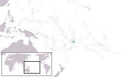
Location map for the Samoa.
Originally created for English Wikipedia by Vardion.
| |
This work has been released into the public domain by its author, Vardion, at the အင်္ဂလိပ် ဝီကီပီးဒီးယား project. This applies worldwide. In case this is not legally possible: |
ဖိုင်မှတ်တမ်း
ဖိုင်ကို ယင်းနေ့စွဲ အတိုင်း မြင်နိုင်ရန် နေ့စွဲ/အချိန် တစ်ခုခုပေါ်တွင် ကလစ်နှိပ်ပါ။
| နေ့စွဲ/အချိန် | နမူနာပုံငယ် | မှတ်တမ်း ဒိုင်မန်းရှင်းများ | အသုံးပြုသူ | မှတ်ချက် | |
|---|---|---|---|---|---|
| ကာလပေါ် | ၀၀:၂၈၊ ၅ စက်တင်ဘာ ၂၀၁၀ | | ၂၄၈ × ၁၅၆ (၃ KB) | Ras67 | cropped and squeezed |
| ၁၅:၂၀၊ ၂၁ ဒီဇင်ဘာ ၂၀၀၄ |  | ၂၅၀ × ၁၅၈ (၆ KB) | EugeneZelenko | Location map for the Samoa.<br/>Originally created for English Wikipedia by Vardion.<br/>{{PD}}<br/>Category:Country locator maps |
ဖိုင်သုံးစွဲမှု
အောက်ပါ စာမျက်နှာ သည် ဤဖိုင်ကို အသုံးပြုထားသည်:
ဂလိုဘယ် ဖိုင်သုံးစွဲမှု
အောက်ပါ အခြားဝီကီများတွင် ဤဖိုင်ကို အသုံးပြုထားသည်-
- af.wikipedia.org တွင် အသုံးပြုမှု
- ar.wikipedia.org တွင် အသုံးပြုမှု
- قرار مجلس الأمن التابع للأمم المتحدة رقم 399
- معاملة المثليين في ساموا
- مستخدم:جار الله/قائمة صور مقالات العلاقات الثنائية
- العلاقات الأمريكية الساموية
- العلاقات الأنغولية الساموية
- العلاقات الساموية الكورية الجنوبية
- العلاقات الإريترية الساموية
- العلاقات الساموية السويسرية
- العلاقات الألمانية الساموية
- العلاقات الساموية الليختنشتانية
- العلاقات البوليفية الساموية
- العلاقات الساموية الموزمبيقية
- العلاقات الألبانية الساموية
- العلاقات البلجيكية الساموية
- العلاقات الإثيوبية الساموية
- العلاقات البيلاروسية الساموية
- العلاقات الساموية الطاجيكستانية
- العلاقات الروسية الساموية
- العلاقات الرومانية الساموية
- العلاقات الأرجنتينية الساموية
- العلاقات الساموية الغامبية
- العلاقات الساموية القبرصية
- العلاقات الساموية السيراليونية
- العلاقات الساموية النيبالية
- العلاقات الساموية الليبيرية
- العلاقات التشيكية الساموية
- العلاقات الساموية الميانمارية
- العلاقات الساموية الكندية
- العلاقات السعودية الساموية
- العلاقات الزيمبابوية الساموية
- العلاقات الإسرائيلية الساموية
- العلاقات البالاوية الساموية
- العلاقات الساموية المالية
- العلاقات الساموية النيجيرية
- العلاقات اليمنية الساموية
- العلاقات الساموية الفانواتية
- العلاقات الغابونية الساموية
- العلاقات البنمية الساموية
- العلاقات الساموية الكوبية
- العلاقات الجورجية الساموية
- العلاقات التونسية الساموية
- العلاقات الساموية الكورية الشمالية
- العلاقات الهندية الساموية
- العلاقات اليابانية الساموية
- العلاقات الإيطالية الساموية
- العلاقات الساموية الناوروية
- العلاقات الأسترالية الساموية
- العلاقات الزامبية الساموية
- العلاقات الساموية الفيجية
ဤဖိုင်ကို အခြားနေရာများတွင် အသုံးပြုထားမှုများအား ကြည့်ရှုရန်။