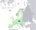
ဖိုင်:Location Czech Republic EU Europe.png

ဤနမူနာ၏ အရွယ်အစား - ၇၂၁ × ၆၀၀ ပစ်ဇယ်။ အခြား ပုံရိပ်ပြတ်သားမှု: ၂၈၉ × ၂၄၀ ပစ်ဇယ် | ၅၇၇ × ၄၈၀ ပစ်ဇယ် | ၉၂၃ × ၇၆၈ ပစ်ဇယ် | ၁၂၃၁ × ၁၀၂၄ ပစ်ဇယ် | ၂၀၅၆ × ၁၇၁၀ ပစ်ဇယ်။
မူရင်းဖိုင် (၂၀၅၆ × ၁၇၁၀ pixels, ဖိုင်အရွယ်အစား - ၁၄၂ KB, MIME အမျိုးအစား image/png)
ဖိုင်မှတ်တမ်း
ဖိုင်ကို ယင်းနေ့စွဲ အတိုင်း မြင်နိုင်ရန် နေ့စွဲ/အချိန် တစ်ခုခုပေါ်တွင် ကလစ်နှိပ်ပါ။
| နေ့စွဲ/အချိန် | နမူနာပုံငယ် | မှတ်တမ်း ဒိုင်မန်းရှင်းများ | အသုံးပြုသူ | မှတ်ချက် | |
|---|---|---|---|---|---|
| ကာလပေါ် | ၀၈:၀၂၊ ၁၂ အောက်တိုဘာ ၂၀၂၂ |  | ၂၀၅၆ × ၁၇၁၀ (၁၄၂ KB) | Рагин1987 | Extended map |
| ၂၀:၃၆၊ ၂၁ စက်တင်ဘာ ၂၀၀၉ |  | ၂၀၅၆ × ၁၇၁၀ (၁၆၆ KB) | Bruno Rosta | {{Information |Description={{en|1=Location map: Czech Republic (dark green) / European Union (light green) / Europe (dark grey); inspired by and consistent with general country locator maps by User:Vardion, et al |Source=Vectorization of [[Image:Loca |
ဖိုင်သုံးစွဲမှု
ဤဖိုင်ကို အသုံးပြုထားသော စာမျက်နှာများမရှိပါ။
ဂလိုဘယ် ဖိုင်သုံးစွဲမှု
အောက်ပါ အခြားဝီကီများတွင် ဤဖိုင်ကို အသုံးပြုထားသည်-
- sr.wikibooks.org တွင် အသုံးပြုမှု
- te.wikipedia.org တွင် အသုံးပြုမှု
