ဖိုင်:Punjab locator map.svg

မူရင်းဖိုင် (SVG ဖိုင်, ၉၅၅ × ၁၀၂၉ pixels ကို အကြံပြုသည်, ဖိုင်အရွယ်အစား - ၁၇၄ KB)
| ဤဖိုင်သည် Wikimedia Commons မှဖြစ်ပြီး အခြားပရောဂျက်များတွင် သုံးကောင်းသုံးလိမ့်မည်။ ယင်း၏ ဖိုင်အကြောင်းစာမျက်နှာ တွင် ဖော်ပြထားချက်ကို အောက်တွင် ပြထားသည်။ Commons သည် မူပိုင်ခွင့်လွတ်လပ်သော မီဒီယာဖိုင်များ သိုလှောင်ထားရာ နေရာ ဖြစ်သည်။ သင်လည်း ပါဝင်ကူညီနိုင်ပါသည်။ |
| ခေါင်းစဥ် |
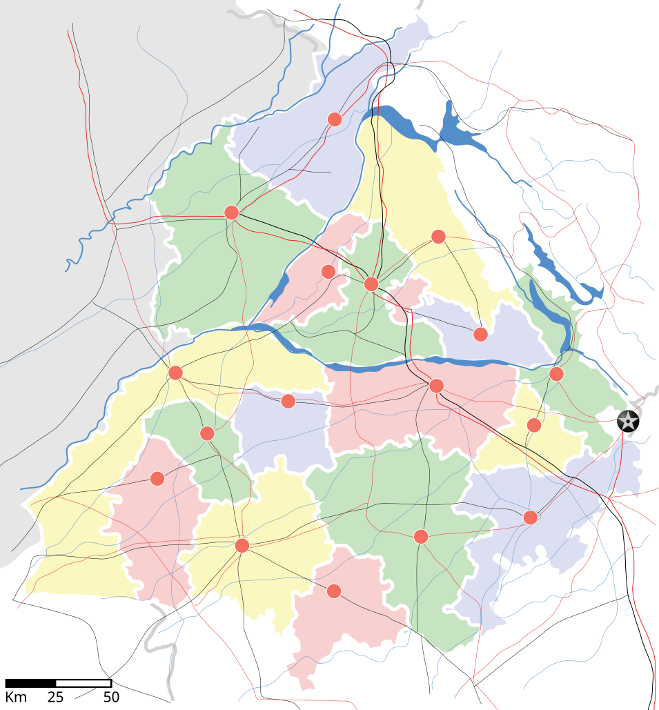
Punjab locator map |
||
| Description | |||
| ရက်စွဲ | |||
| ရင်းမြစ် |
ကိုယ်ပိုင်ဖန်တီးမှု |
||
| ဖန်ဆင်းရှင် |
|
||
| ခွင့်ပြုချက် (ဤဖိုင်ကို ပြန်လည်အသုံးပြုခြင်း) |
ကျွန်ုပ်၊ ဤလုပ်ဆောင်ချက်၏ မူပိုင်ခွင့်ပိုင်ရှင်အနေဖြင့် ဤနေရာမှ အောက်ပါလိုင်စင်အောက်တွင် ထုတ်လွှင့်ပါသည်: ဤဖိုင်ကို Creative Commons Attribution-Share Alike 3.0 Unported လိုင်စင်ဖြင့် သတ်မှတ်ထားသည်။
|
||
| Geotemporal data | |||
| Date depicted | second half of 20 century နှင့် 21 century | ||
| Georeferencing | If inappropriate please set warp_status = skip to hide. | ||
| Archival data | |||
| Notes | Part of WikiProject India Maps | ||
derivative works
Derivative works of this file: Districts of Punjab, India.svg
ဖိုင်မှတ်တမ်း
ဖိုင်ကို ယင်းနေ့စွဲ အတိုင်း မြင်နိုင်ရန် နေ့စွဲ/အချိန် တစ်ခုခုပေါ်တွင် ကလစ်နှိပ်ပါ။
| နေ့စွဲ/အချိန် | နမူနာပုံငယ် | မှတ်တမ်း ဒိုင်မန်းရှင်းများ | အသုံးပြုသူ | မှတ်ချက် | |
|---|---|---|---|---|---|
| ကာလပေါ် | ၁၈:၂၇၊ ၂၅ ဧပြီ ၂၀၀၇ | | ၉၅၅ × ၁၀၂၉ (၁၇၄ KB) | Planemad | reupload, forgot crop |
| ၁၈:၂၅၊ ၂၅ ဧပြီ ၂၀၀၇ |  | ၂၃၉၃ × ၁၉၅၆ (၁၈၈ KB) | Planemad | {{WikiProject_India_Maps |Title=Punjab locator map |Description=Locator map of the state of w:Punjab, India with district boundaries, major highways, railways and water bodies. |Source=[www.punjabtourism.org/tt_maps.php Punjab Tourism - Ma |
ဖိုင်သုံးစွဲမှု
ဤဖိုင်ကို အသုံးပြုထားသော စာမျက်နှာများမရှိပါ။
ဂလိုဘယ် ဖိုင်သုံးစွဲမှု
အောက်ပါ အခြားဝီကီများတွင် ဤဖိုင်ကို အသုံးပြုထားသည်-
- ar.wikipedia.org တွင် အသုံးပြုမှု
- ast.wikipedia.org တွင် အသုံးပြုမှု
- as.wikipedia.org တွင် အသုံးပြုမှု
- awa.wikipedia.org တွင် အသုံးပြုမှု
- bh.wikipedia.org တွင် အသုံးပြုမှု
- bn.wikipedia.org တွင် အသုံးပြုမှု
- ca.wikipedia.org တွင် အသုံးပြုမှု
- ceb.wikipedia.org တွင် အသုံးပြုမှု
- ckb.wikipedia.org တွင် အသုံးပြုမှု
- de.wikipedia.org တွင် အသုံးပြုမှု
- dty.wikipedia.org တွင် အသုံးပြုမှု
- el.wikipedia.org တွင် အသုံးပြုမှု
- eo.wikipedia.org တွင် အသုံးပြုမှု
- es.wikipedia.org တွင် အသုံးပြုမှု
- eu.wikipedia.org တွင် အသုံးပြုမှု
- fa.wikipedia.org တွင် အသုံးပြုမှု
- fr.wikipedia.org တွင် အသုံးပြုမှု
- hi.wikipedia.org တွင် အသုံးပြုမှု
- फिल्लौर
- साँचा:पंजाब के लोकसभा निर्वाचन क्षेत्र
- संगरूर लोक सभा निर्वाचन क्षेत्र
- अमृतसर लोक सभा निर्वाचन क्षेत्र
- भटिंडा लोक सभा निर्वाचन क्षेत्र
- फरीदकोट लोक सभा निर्वाचन क्षेत्र
- फतेहगढ़ साहिब लोक सभा निर्वाचन क्षेत्र
- आनंदपुर साहिब लोक सभा निर्वाचन क्षेत्र
- फिरोजपुर लोक सभा निर्वाचन क्षेत्र
- गुरदासपुर लोक सभा निर्वाचन क्षेत्र
- होशियारपुर लोक सभा निर्वाचन क्षेत्र
- जलंधर लोक सभा निर्वाचन क्षेत्र
- खडूर साहिब लोक सभा निर्वाचन क्षेत्र
- लुधियाना लोक सभा निर्वाचन क्षेत्र
- पटियाला लोक सभा निर्वाचन क्षेत्र
- थरियाल
- माधोपुर, पंजाब
- hu.wikipedia.org တွင် အသုံးပြုမှု
- hy.wikipedia.org တွင် အသုံးပြုမှု
- id.wikipedia.org တွင် အသုံးပြုမှု
- ja.wikipedia.org တွင် အသုံးပြုမှု
- kn.wikipedia.org တွင် အသုံးပြုမှု
- mai.wikipedia.org တွင် အသုံးပြုမှု
- mg.wikipedia.org တွင် အသုံးပြုမှု
- ml.wikipedia.org တွင် အသုံးပြုမှု
ဤဖိုင်ကို အခြားနေရာများတွင် အသုံးပြုထားမှုများအား ကြည့်ရှုရန်။