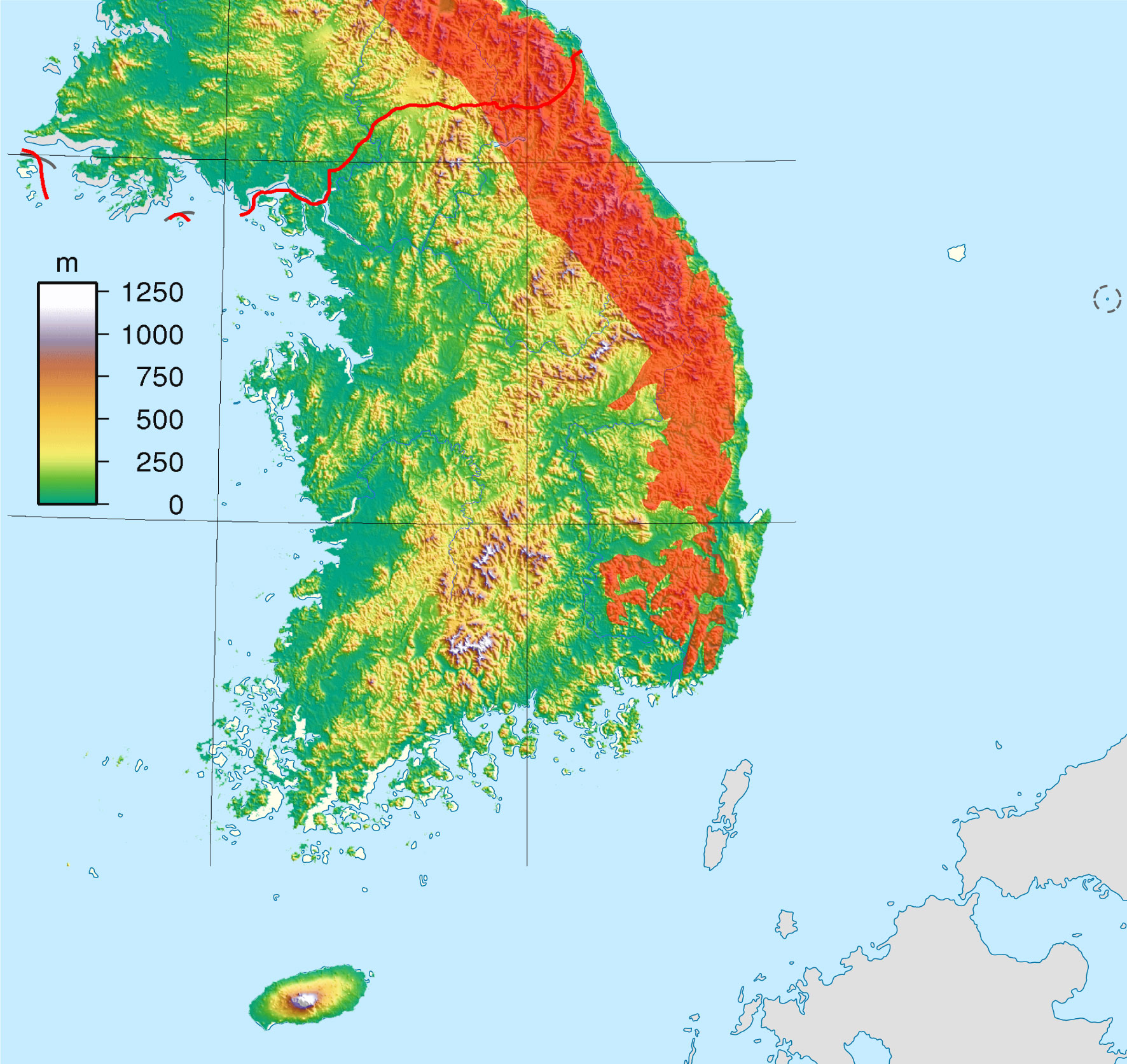
ဖိုင်:South Korea location map topography with taebaek mountains marked.jpg
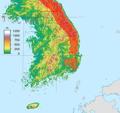
ဤနမူနာ၏ အရွယ်အစား - ၆၃၅ × ၅၉၉ ပစ်ဇယ်။ အခြား ပုံရိပ်ပြတ်သားမှု: ၂၅၄ × ၂၄၀ ပစ်ဇယ် | ၅၀၉ × ၄၈၀ ပစ်ဇယ် | ၈၁၄ × ၇၆၈ ပစ်ဇယ် | ၁၀၈၅ × ၁၀၂၄ ပစ်ဇယ် | ၁၇၇၂ × ၁၆၇၂ ပစ်ဇယ်။
မူရင်းဖိုင် (၁၇၇၂ × ၁၆၇၂ pixels, ဖိုင်အရွယ်အစား - ၅၆၃ KB, MIME အမျိုးအစား image/jpeg)
| ဤဖိုင်သည် Wikimedia Commons မှဖြစ်ပြီး အခြားပရောဂျက်များတွင် သုံးကောင်းသုံးလိမ့်မည်။ ယင်း၏ ဖိုင်အကြောင်းစာမျက်နှာ တွင် ဖော်ပြထားချက်ကို အောက်တွင် ပြထားသည်။ Commons သည် မူပိုင်ခွင့်လွတ်လပ်သော မီဒီယာဖိုင်များ သိုလှောင်ထားရာ နေရာ ဖြစ်သည်။ သင်လည်း ပါဝင်ကူညီနိုင်ပါသည်။ |
| ဖော်ပြချက် | Topography map version designed to be used as an alternative map to File:South Korea location map.svg with the Taebaek Mountains region marked in red |
| ရက်စွဲ | (UTC) |
| ရင်းမြစ် | |
| စာရေးသူ |
|
| This is a retouched picture, which means that it has been digitally altered from its original version. The original can be viewed here: South Korea Topography.png:
|
ဤဖိုင်ကို Creative Commons Attribution-Share Alike 3.0 Unported လိုင်စင်ဖြင့် သတ်မှတ်ထားသည်။
- သင်သည် လွတ်လပ်စွာ:
- မျှဝေရန် – ဖန်တီးမှုကို ကူးယူရန်၊ ဖြန့်ဖြူးရန်နှင့် ထုတ်လွှင့်ရန်
- ပြန်ရောနှောရန် – ဖန်တီးမှုကို ပြင်ဆင်ညှိနှိုင်းရန်
- အောက်ပါ အခြေအနေများတွင်:
- မှတ်ယူနိုင်ခြင်း – ပြောင်းလဲမှုများ ပြုလုပ်ခဲ့ပါက ဖန်တီးသူ သို့မဟုတ် လိုင်စင်ရှိသူမှ သတ်မှတ်သော အမျိုးအစားကို လိုက်နာရမည် (ဆိုလိုသည်မှာ သင့်အား သို့မဟုတ် သင့်ဖန်တီးမှုတွင် အသုံးပြုခြင်းအား ထောက်ခံချက်ပေးသည်ဟု မဆိုလိုပါ)။
- ထပ်တူမျှဝေ – ဤဖန်တီးမှုအား ပြင်ဆင်ခြင်း၊ ပြောင်းလဲခြင်း သို့မဟုတ် ထပ်ဆင့် ဖန်တီးခြင်း ပြုလုပ်ပါက ရရှိလာသော ဖန်တီးမှုကို ဤဖန်တီးမှုနှင့် သို့မဟုတ် ဆင်တူသော လိုင်စင်ဖြင့်သာ ဖြန့်ချိသင့်သည်။
မူရင်းတင်ထားသောမှတ်တမ်း
This image is a derivative work of the following images:
- File:South_Korea_location_map.svg licensed with Cc-by-sa-3.0, GFDL
- 2010-10-02T20:05:03Z NordNordWest 1559x1672 (357245 Bytes) upd
- 2008-08-26T18:57:44Z NordNordWest 1559x1673 (513639 Bytes) {{Information |Description= {{de|Positionskarte von [[:de:Südkorea|Südkorea]]}} Quadratische Plattkarte, N-S-Streckung 120 %. Geographische Begrenzung der Karte: * N: 38.9° N * S: 33.0° N * W: 124.5° O * O: 131.1° O {{e
- File:South_Korea_Topography.png licensed with Cc-by-sa-3.0,2.5,2.0,1.0, GFDL
- 2007-09-01T17:43:59Z Sadalmelik 1705x1979 (2489211 Bytes) {{Information |Description=Topographic map of South Korea. Created wth GMT from SRTM data. |Source=self-made |Date=Sep 1, 2007 |Author= [[User:Sadalmelik|Sadalmelik]] }} [[Category:Topographi
Uploaded with derivativeFX
ဖိုင်မှတ်တမ်း
ဖိုင်ကို ယင်းနေ့စွဲ အတိုင်း မြင်နိုင်ရန် နေ့စွဲ/အချိန် တစ်ခုခုပေါ်တွင် ကလစ်နှိပ်ပါ။
| နေ့စွဲ/အချိန် | နမူနာပုံငယ် | မှတ်တမ်း ဒိုင်မန်းရှင်းများ | အသုံးပြုသူ | မှတ်ချက် | |
|---|---|---|---|---|---|
| ကာလပေါ် | ၀၃:၅၈၊ ၇ နိုဝင်ဘာ ၂၀၁၀ | | ၁၇၇၂ × ၁၆၇၂ (၅၆၃ KB) | 배우는사람 | new version - Dokdo is included |
| ၂၃:၁၇၊ ၂၁ အောက်တိုဘာ ၂၀၁၀ |  | ၁၅၅၉ × ၁၆၇၂ (၅၅၅ KB) | 배우는사람 | {{Information |Description=Topography map version designed to be used as an alternative map to File:South Korea location map.svg with the Taebaek Mountains region marked in red |Source=*File:South_Korea_location_map.svg *[[:File:South_Korea_Top |
ဖိုင်သုံးစွဲမှု
အောက်ပါ စာမျက်နှာ သည် ဤဖိုင်ကို အသုံးပြုထားသည်:
ဂလိုဘယ် ဖိုင်သုံးစွဲမှု
အောက်ပါ အခြားဝီကီများတွင် ဤဖိုင်ကို အသုံးပြုထားသည်-
- bg.wikipedia.org တွင် အသုံးပြုမှု
- cs.wikipedia.org တွင် အသုံးပြုမှု
- en.wikipedia.org တွင် အသုံးပြုမှု
- es.wikipedia.org တွင် အသုံးပြုမှု
- id.wikipedia.org တွင် အသုံးပြုမှု
- ko.wikipedia.org တွင် အသုံးပြုမှု
- nn.wikipedia.org တွင် အသုံးပြုမှု
- pl.wikipedia.org တွင် အသုံးပြုမှု
- pt.wikipedia.org တွင် အသုံးပြုမှု
- ru.wikipedia.org တွင် အသုံးပြုမှု
- uk.wikipedia.org တွင် အသုံးပြုမှု
- vi.wikipedia.org တွင် အသုံးပြုမှု