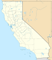
ဖိုင်:USA California location map.svg

Size of this PNG preview of this SVG file: ၅၂၃ × ၅၉၉ ပစ်ဇယ်. အခြား ပုံရိပ်ပြတ်သားမှု: ၂၀၉ × ၂၄၀ ပစ်ဇယ် | ၄၁၉ × ၄၈၀ ပစ်ဇယ် | ၆၇၀ × ၇၆၈ ပစ်ဇယ် | ၈၉၄ × ၁၀၂၄ ပစ်ဇယ် | ၁၇၈၇ × ၂၀၄၈ ပစ်ဇယ် | ၁၀၂၂ × ၁၁၇၁ ပစ်ဇယ်။
မူရင်းဖိုင် (SVG ဖိုင်, ၁၀၂၂ × ၁၁၇၁ pixels ကို အကြံပြုသည်, ဖိုင်အရွယ်အစား - ၄၈၀ KB)
ဖိုင်မှတ်တမ်း
ဖိုင်ကို ယင်းနေ့စွဲ အတိုင်း မြင်နိုင်ရန် နေ့စွဲ/အချိန် တစ်ခုခုပေါ်တွင် ကလစ်နှိပ်ပါ။
| နေ့စွဲ/အချိန် | နမူနာပုံငယ် | မှတ်တမ်း ဒိုင်မန်းရှင်းများ | အသုံးပြုသူ | မှတ်ချက် | |
|---|---|---|---|---|---|
| ကာလပေါ် | ၁၉:၁၇၊ ၅ ဇွန် ၂၀၀၉ |  | ၁၀၂၂ × ၁၁၇၁ (၄၈၀ KB) | NordNordWest | more detailed |
| ၂၁:၅၀၊ ၁၂ မတ် ၂၀၀၉ |  | ၁၀၂၀ × ၁၁၆၉ (၃၈၅ KB) | NordNordWest | {{Information |Description= {{de|Positionskarte von Kalifornien, USA}} Quadratische Plattkarte, N-S-Streckung 125 %. Geographische Begrenzung der Karte: * N: 42.2° N * S: 32.3° N * W: 124.7° W * O: 113.9° W {{en|Locatio |
ဖိုင်သုံးစွဲမှု
အောက်ပါ 3 စာမျက်နှာများ သည် ဤဖိုင်ကို အသုံးပြုထားသည်:
ဂလိုဘယ် ဖိုင်သုံးစွဲမှု
အောက်ပါ အခြားဝီကီများတွင် ဤဖိုင်ကို အသုံးပြုထားသည်-
- af.wikipedia.org တွင် အသုံးပြုမှု
- als.wikipedia.org တွင် အသုံးပြုမှု
- an.wikipedia.org တွင် အသုံးပြုမှု
- ar.wikipedia.org တွင် အသုံးပြုမှု
- يونيفرسال سيتي
- قالب:ص.م/موقع جغرافي متعدد
- قالب:خريطة مواقع الولايات المتحدة/كاليفورنيا
- قالب:ص.م/موقع جغرافي متعدد/شرح
- مطار رينو تاهو الدولي
- خطوط الاسكا الجوية الرحلة 261
- برج ليليان كويت
- حادثة إطلاق النار بمطار لوس أنجلوس الدولي 2002
- قصر وينشستر الغامض
- زلزال نورثريدج 1994
- زامبيريني فيلد
- قالب:ص.م/موقع جغرافي متعدد/ملعب
- ast.wikipedia.org တွင် အသုံးပြုမှု
- Aeropuertu Internacional de Los Angeles
- Aeropuertu de Long Beach
- Aeropuertu Internacional d'Oakland
- Aeropuertu Internacional LA/Ontario
- Aeropuertu Internacional de Sacramento
- Aeropuertu Públicu de Santa María
- Módulu:Mapa de llocalización/datos/California
- Módulu:Mapa de llocalización/datos/California/usu
- azb.wikipedia.org တွင် အသုံးပြုမှု
ဤဖိုင်ကို အခြားနေရာများတွင် အသုံးပြုထားမှုများအား ကြည့်ရှုရန်။

