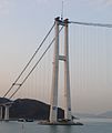
ဖိုင်:Yi Sun-sin Bridge in construction2.jpg

ဤနမူနာ၏ အရွယ်အစား - ၈၀၀ × ၅၃၇ ပစ်ဇယ်။ အခြား ပုံရိပ်ပြတ်သားမှု: ၃၂၀ × ၂၁၅ ပစ်ဇယ် | ၆၄၀ × ၄၃၀ ပစ်ဇယ် | ၁၀၂၄ × ၆၈၇ ပစ်ဇယ် | ၁၂၈၀ × ၈၅၉ ပစ်ဇယ် | ၂၈၉၆ × ၁၉၄၄ ပစ်ဇယ်။
မူရင်းဖိုင် (၂၈၉၆ × ၁၉၄၄ pixels, ဖိုင်အရွယ်အစား - ၁.၆၃ MB, MIME အမျိုးအစား image/jpeg)
ဖိုင်မှတ်တမ်း
ဖိုင်ကို ယင်းနေ့စွဲ အတိုင်း မြင်နိုင်ရန် နေ့စွဲ/အချိန် တစ်ခုခုပေါ်တွင် ကလစ်နှိပ်ပါ။
| နေ့စွဲ/အချိန် | နမူနာပုံငယ် | မှတ်တမ်း ဒိုင်မန်းရှင်းများ | အသုံးပြုသူ | မှတ်ချက် | |
|---|---|---|---|---|---|
| ကာလပေါ် | ၁၇:၃၀၊ ၁၀ မတ် ၂၀၁၃ |  | ၂၈၉၆ × ၁၉၄၄ (၁.၆၃ MB) | Glabb | {{Information |Description=이순신대교(李舜臣大橋) |Source=[http://www.panoramio.com/photo/73890910 panoramio] |Date=2011-12-28 07:59 |Author=[http://www.panoramio.com/user/5022179 gogotea] |Permission= |other_versions= }} {{Location dec|34.90... |
ဖိုင်သုံးစွဲမှု
အောက်ပါ စာမျက်နှာ သည် ဤဖိုင်ကို အသုံးပြုထားသည်:
ဂလိုဘယ် ဖိုင်သုံးစွဲမှု
အောက်ပါ အခြားဝီကီများတွင် ဤဖိုင်ကို အသုံးပြုထားသည်-
- ar.wikipedia.org တွင် အသုံးပြုမှု
- bn.wikipedia.org တွင် အသုံးပြုမှု
- en.wikipedia.org တွင် အသုံးပြုမှု
- es.wikipedia.org တွင် အသုံးပြုမှု
- ko.wikipedia.org တွင် အသုံးပြုမှု
