ဘရွန်ဘိကိုတိုကန်
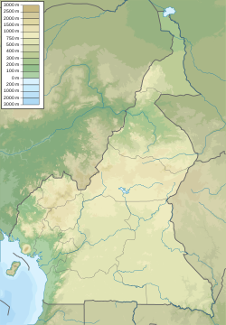
ဘရွန်ဘိကိုတိုကန် သည် ကင်မရွန်းနိုင်ငံအနောက်တောင်ပိုင်းရှိ ကန်ငယ်တစ်ခု ဖြစ်သည်။ ဤကန်သည် မီးတောင်မှ ဖြစ်ပေါ်လာသည့် ကန်တစ်ခုဖြစ်ပြီး အချင်းသည် ၁.၂ ကီလိုမီတာခန့် (၀.၇၅ မိုင်) ဖြစ်သည်။ ကန်၏ အလယ်တွင် သေးငယ်သည့် ကျွန်းတစ်ခု တည်ရှိသည်။ Tung Nsuia နှင့် Tung Nsuria တို့သည် ကန်၏ အဝတွင် တည်ရှိသည်။ ထိုချောင်းတစ်ခုချင်းစီသည် ၁-၂ မီတာ (၃ပေ ၃လက်မ - ၆ ပေ ၇ လက်မ) အကျယ်ရှိကာ အနက်သည် ၀.၃ မီတာ (၁ ပေ) ရှိသည်။ ခြောက်သွေ့သည့် ရာသီချိန်တွင် ဤကန်သည် ခန်းခြောက်သည်။[၂]
| ဘရွန်ဘိကိုတိုကန် Lake Barombi Koto | |
|---|---|
 Of the three visible lakes, Barombi Koto is the relatively small circular lake in the southwest. | |
| ကိုဩဒိနိတ် | 4°28′N 9°16′E / 4.467°N 9.267°Eကိုဩဒိနိတ်: 4°28′N 9°16′E / 4.467°N 9.267°E |
| အမျိုးအစား | Volcanic crater lake |
| ပင်မ ရေဝင်စီးကြောင်း | Tung Nsuia and Tung Nsuria streams[၁] (dry out in dry season)[၂] |
| ပင်မ ရေထွက်စီးကြောင်း | Nkundung-Kotto Stream (dries out or greatly reduced in dry season), which is a tributary of the Meme River[၂] |
| ရေချိုင့်ဝှမ်းရှိရာ နိုင်ငံများ | Cameroon |
| အကျယ်ဆုံး အလျား | ၂.၂ km (၁.၄ mi)[၂] |
| အကျယ်ဆုံး အနံ | ၂ km (၁.၂ mi)[၂] |
| မျက်နှာပြင် ဧရိယာ | ၃၃၀ ဟက်တာ (၈၂၀ ဧက)[၂] |
| ပျမ်းမျှအနက် | ၃.၈ m (၁၂ ft)[၂] |
| အနက်ဆုံး အနက်အရှိုင်း | ၆.၂ m (၂၀ ft)[၂] |
| ရေထုထည် | ၁,၂၄၈,၀၀၀ m3 (၄၄,၁၀၀,၀၀၀ cu ft)[၂] |
| ပင်လယ်ရေ မျက်နှာပြင်အမြင့် | ၁၁၀ m (၃၆၀ ft)[၂] |
| ကျွန်းများ | Kotto (name of village on small island)[၂] |
ကိုးကား
ပြင်ဆင်ရန်- ↑ Corbet, S. A., J. Green, J. Griffith, and E. Betney (1973). Ecological studies on crater lakes in West Cameroon Lakes Kotto and Mboandong.[လင့်ခ်သေ] Journal of Zoology 170: 309–324
- ↑ ၂.၀၀ ၂.၀၁ ၂.၀၂ ၂.၀၃ ၂.၀၄ ၂.၀၅ ၂.၀၆ ၂.၀၇ ၂.၀၈ ၂.၀၉ ၂.၁၀ Trewavas, E. (1962). Fishes of the Crater Lakes of the Northwestern Cameroons.[လင့်ခ်သေ] Bonner Zoologische Beitraege 13: 146–190

