အယ်မန်တေတာကန်
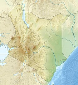
အယ်မန်တေတာကန် သည် ကင်ညာနိုင်ငံအနောက်မြောက်ဘက် ၁၂၀ ကီလိုမီတာခန့်အကွာ မြေနိမ့်လွင်ပြင်ဒေသကြီးတွင် တည်ရှိသည့် ဆိုဒါကန် တစ်ခု ဖြစ်သည်။[၂]
| အယ်မန်တေတာကန် | |
|---|---|
 | |
| ကိုဩဒိနိတ် | 0°27′S 36°15′E / 0.450°S 36.250°Eကိုဩဒိနိတ်: 0°27′S 36°15′E / 0.450°S 36.250°E |
| ရေချိုင့်ဝှမ်းရှိရာ နိုင်ငံများ | Kenya |
| မျက်နှာပြင် ဧရိယာ | ၁၈ km2 (၆.၉ sq mi) |
| ပင်လယ်ရေ မျက်နှာပြင်အမြင့် | ၁,၆၇၀ m (၅,၄၈၀ ft) ASL |
| ရွေးချယ်ခြင်း | 5 September 2005 |
| ရည်ညွှန်းနံပါတ် | 1498[၁] |
ပထဝီသွင်ပြင်
ပြင်ဆင်ရန်သမိုင်းကြောင်း
ပြင်ဆင်ရန်ဤကန်ကို ပထမဆုံးမြင်တွေ့ခဲ့သူမှာ ပထမဆုံးလူဖြူအခြေချနေထိုင်သူ ဖြစ်သည့် Lord Delamere (1879-1931) ဖြစ်သည်။ [၃]
သက်ရှိဆိုင်ရာ
ပြင်ဆင်ရန်ဆက်စပ်နေသည့် နေရာများ
ပြင်ဆင်ရန်ကိုးကား
ပြင်ဆင်ရန်- ↑ Lake Elmenteita။ 25 April 2018 တွင် ပြန်စစ်ပြီး။
- ↑ Scoon၊ Roger N. (2018)၊ "Lakes of the Gregory Rift Valley: Baringo, Bogoria, Nakuru, Elmenteita, Magadi, Manyara and Eyasi"၊ Geology of National Parks of Central/Southern Kenya and Northern Tanzania၊ Springer International Publishing၊ pp. 167–180၊ doi:10.1007/978-3-319-73785-0_15၊ ISBN 978-3-319-73784-3
- ↑ Peck၊ Dwight (17 September 2005)။ Lake Elmenteita added to the Ramsar List။ The Ramsar Convention on Wetlands။ November 14, 2008 တွင် မူရင်းအား မော်ကွန်းတင်ပြီး။ 2009-04-19 တွင် ပြန်စစ်ပြီး။

