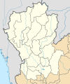
ဖိုင်:Thailand Northern (17 provinces) location map.svg

Size of this PNG preview of this SVG file: ၅၀၀ × ၆၀၀ ပစ်ဇယ်. အခြား ပုံရိပ်ပြတ်သားမှု: ၂၀၀ × ၂၄၀ ပစ်ဇယ် | ၄၀၀ × ၄၈၀ ပစ်ဇယ် | ၆၄၀ × ၇၆၈ ပစ်ဇယ် | ၈၅၃ × ၁၀၂၄ ပစ်ဇယ် | ၁၇၀၇ × ၂၀၄၈ ပစ်ဇယ် | ၆၀၀ × ၇၂၀ ပစ်ဇယ်။
မူရင်းဖိုင် (SVG ဖိုင်, ၆၀၀ × ၇၂၀ pixels ကို အကြံပြုသည်, ဖိုင်အရွယ်အစား - ၁၇၈ KB)
ဖိုင်မှတ်တမ်း
ဖိုင်ကို ယင်းနေ့စွဲ အတိုင်း မြင်နိုင်ရန် နေ့စွဲ/အချိန် တစ်ခုခုပေါ်တွင် ကလစ်နှိပ်ပါ။
| နေ့စွဲ/အချိန် | နမူနာပုံငယ် | မှတ်တမ်း ဒိုင်မန်းရှင်းများ | အသုံးပြုသူ | မှတ်ချက် | |
|---|---|---|---|---|---|
| ကာလပေါ် | ၂၁:၂၆၊ ၁၃ စက်တင်ဘာ ၂၀၁၉ |  | ၆၀၀ × ၇၂၀ (၁၇၈ KB) | ZeroSixTwo | User created page with UploadWizard |
ဖိုင်သုံးစွဲမှု
ဤဖိုင်ကို အသုံးပြုထားသော စာမျက်နှာများမရှိပါ။
ဂလိုဘယ် ဖိုင်သုံးစွဲမှု
အောက်ပါ အခြားဝီကီများတွင် ဤဖိုင်ကို အသုံးပြုထားသည်-
- id.wikipedia.org တွင် အသုံးပြုမှု
- th.wikipedia.org တွင် အသုံးပြုမှု
- ไทยลีก 4 ฤดูกาล 2561 – โซนภาคเหนือ
- ไทยแลนด์ อเมเจอร์ลีก ฤดูกาล 2561 – โซนภาคเหนือ
- ไทยลีก 4 ฤดูกาล 2562 – โซนภาคเหนือ
- ไทยแลนด์ อเมเจอร์ลีก ฤดูกาล 2562 – โซนภาคเหนือ
- มอดูล:Location map/data/Thailand Northern (17 provinces)
- ไทยลีก 4 ฤดูกาล 2563 – โซนภาคเหนือ
- ไทยลีก 3 ฤดูกาล 2564–65 – โซนภาคเหนือ
- ไทยแลนด์ อเมเจอร์ลีก ฤดูกาล 2565 – โซนภาคเหนือ
- ไทยลีก 3 ฤดูกาล 2565–66 – โซนภาคเหนือ
- ไทยแลนด์ เซมิโปรลีก ฤดูกาล 2566 – โซนภาคเหนือ
- ไทยแลนด์ อเมเจอร์ลีก ฤดูกาล 2566 – โซนภาคเหนือ
- ไทยลีก 3 ฤดูกาล 2566–67 – โซนภาคเหนือ
- ไทยแลนด์ เซมิโปรลีก ฤดูกาล 2567 – โซนภาคเหนือ
- มอดูล:Location map/data/Thailand Northern (17 provinces)/doc