ဖိုင်:Lake Hibara-ko4.JPG
ဤနမူနာ၏ အရွယ်အစား - ၈၀၀ × ၆၀၀ ပစ်ဇယ်။ အခြား ပုံရိပ်ပြတ်သားမှု: ၃၂၀ × ၂၄၀ ပစ်ဇယ် | ၆၄၀ × ၄၈၀ ပစ်ဇယ် | ၁၀၂၄ × ၇၆၈ ပစ်ဇယ် | ၁၂၈၀ × ၉၆၀ ပစ်ဇယ် | ၂၅၆၀ × ၁၉၂၀ ပစ်ဇယ် | ၃၂၆၄ × ၂၄၄၈ ပစ်ဇယ်။
မူရင်းဖိုင် (၃၂၆၄ × ၂၄၄၈ pixels, ဖိုင်အရွယ်အစား - ၃.၇၆ MB, MIME အမျိုးအစား image/jpeg)
| ဤဖိုင်သည် Wikimedia Commons မှဖြစ်ပြီး အခြားပရောဂျက်များတွင် သုံးကောင်းသုံးလိမ့်မည်။ ယင်း၏ ဖိုင်အကြောင်းစာမျက်နှာ တွင် ဖော်ပြထားချက်ကို အောက်တွင် ပြထားသည်။ Commons သည် မူပိုင်ခွင့်လွတ်လပ်သော မီဒီယာဖိုင်များ သိုလှောင်ထားရာ နေရာ ဖြစ်သည်။ သင်လည်း ပါဝင်ကူညီနိုင်ပါသည်။ |
အကျဉ်းချုပ်
| ဖော်ပြချက် |
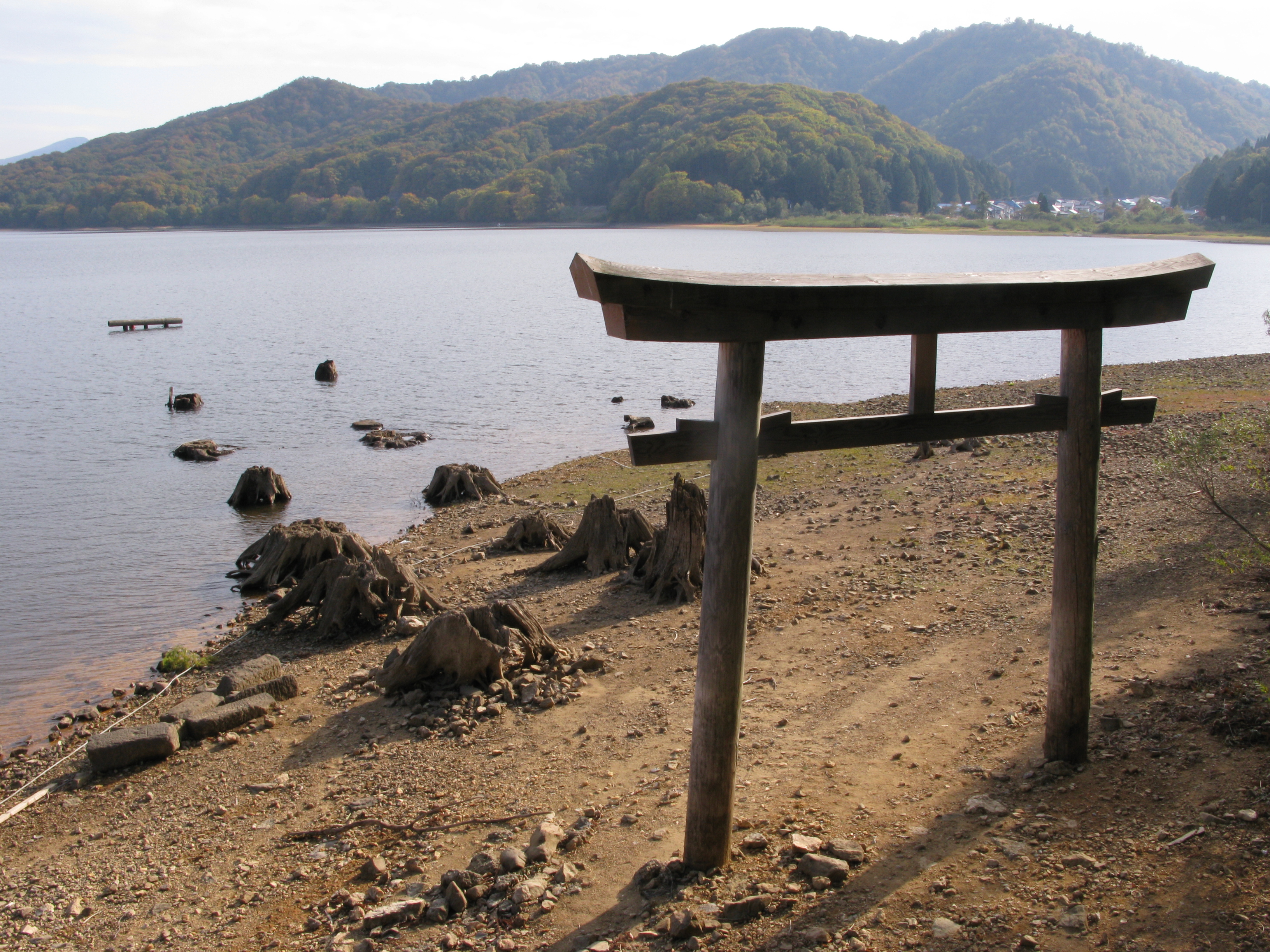
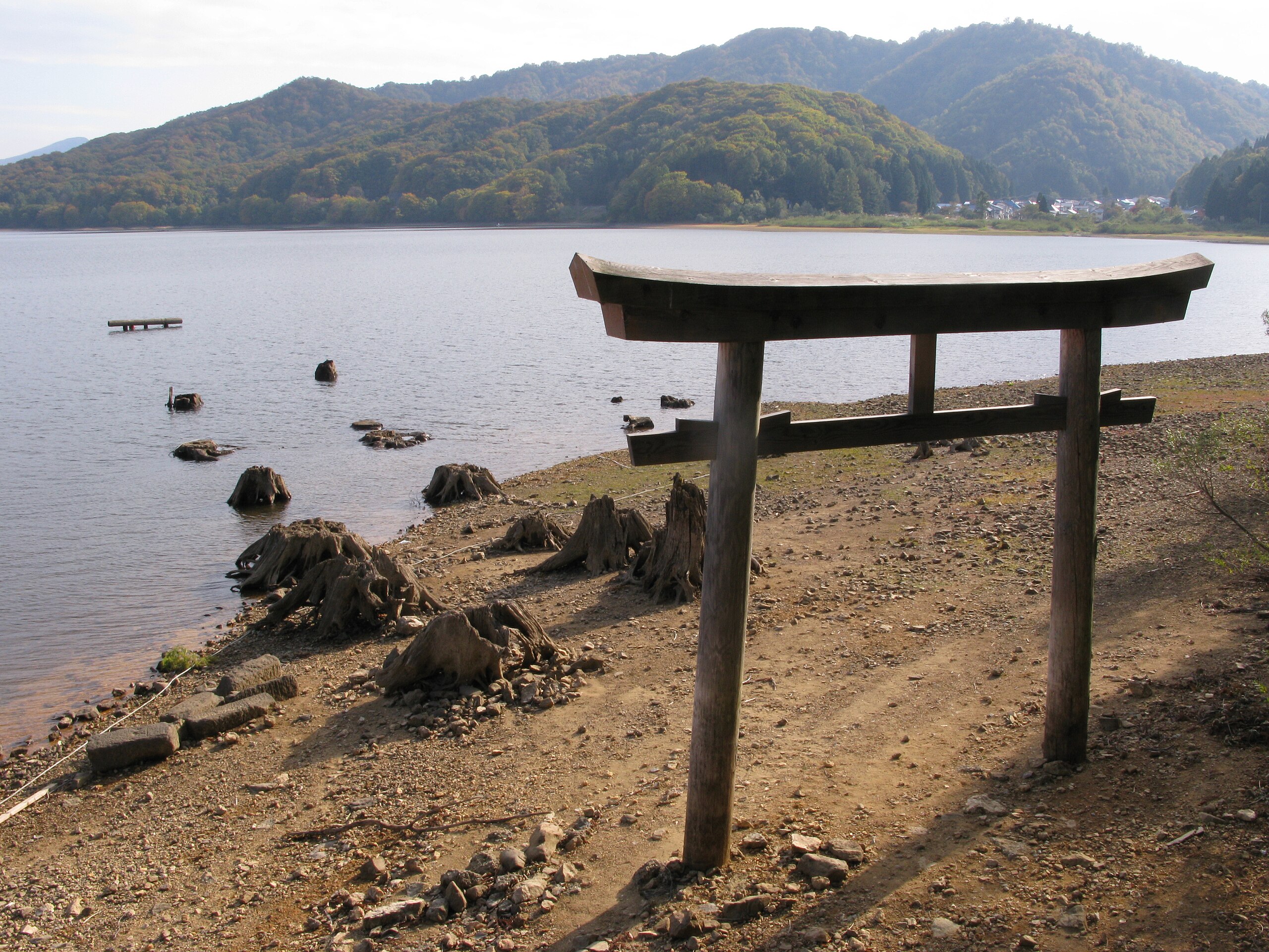
English: Lake Hibara-ko, Torii that goes under water, Fukushima pref., Japan
日本語: 桧原湖 水没した鳥居 福島県 |
| ရက်စွဲ | |
| ရင်းမြစ် | Qwert1234's file |
| စာရေးသူ | Qwert1234 |
| Camera location | | View this and other nearby images on: OpenStreetMap |
|---|
လိုင်စင်သတ်မှတ်ခြင်း
| I, the copyright holder of this work, release this work into the public domain. This applies worldwide. In some countries this may not be legally possible; if so: အကျွန်ုပ်သည် ဤဖန်တီးမှုလက်ရာကို ဥပဒေအရလိုအပ်ခြင်းမရှိသည့် မည်သည့်အခြေအနေမျိုးတွက်မဆို၊ မည်သို့သော ရည်ရွယ်ချက်အတွက်မဆို ၎င်းကို မည်သူမဆို အသုံးပြုပိုင်ခွင့်အား ပေးအပ်သည်။ |
ဖိုင်မှတ်တမ်း
ဖိုင်ကို ယင်းနေ့စွဲ အတိုင်း မြင်နိုင်ရန် နေ့စွဲ/အချိန် တစ်ခုခုပေါ်တွင် ကလစ်နှိပ်ပါ။
| နေ့စွဲ/အချိန် | နမူနာပုံငယ် | မှတ်တမ်း ဒိုင်မန်းရှင်းများ | အသုံးပြုသူ | မှတ်ချက် | |
|---|---|---|---|---|---|
| ကာလပေါ် | ၁၄:၁၃၊ ၁၄ အောက်တိုဘာ ၂၀၀၉ | | ၃၂၆၄ × ၂၄၄၈ (၃.၇၆ MB) | Qwert1234 | {{Information |Description={{en|1=Lake Hibara-ko, Torii that goes under water, Fukushima pref., Japan}} {{ja|1=桧原湖 水没した鳥居 福島県}} |Source=Qwert1234's file |Author=Qwert1234 |Date=2009-10-14 |Permission= |other_versions= }} [[Categor |
ဖိုင်သုံးစွဲမှု
အောက်ပါ စာမျက်နှာ သည် ဤဖိုင်ကို အသုံးပြုထားသည်:
ဂလိုဘယ် ဖိုင်သုံးစွဲမှု
အောက်ပါ အခြားဝီကီများတွင် ဤဖိုင်ကို အသုံးပြုထားသည်-
- de.wikipedia.org တွင် အသုံးပြုမှု
- en.wikipedia.org တွင် အသုံးပြုမှု
- fr.wikipedia.org တွင် အသုံးပြုမှု
- ja.wikipedia.org တွင် အသုံးပြုမှု
- lt.wikipedia.org တွင် အသုံးပြုမှု
- simple.wikipedia.org တွင် အသုံးပြုမှု