ဖိုင်:Locator map of North Korea.svg

Size of this PNG preview of this SVG file: ၂၅၀ × ၁၁၅ ပစ်ဇယ်. အခြား ပုံရိပ်ပြတ်သားမှု: ၃၂၀ × ၁၄၇ ပစ်ဇယ် | ၆၄၀ × ၂၉၄ ပစ်ဇယ် | ၁၀၂၄ × ၄၇၁ ပစ်ဇယ် | ၁၂၈၀ × ၅၈၉ ပစ်ဇယ် | ၂၅၆၀ × ၁၁၇၈ ပစ်ဇယ်။
မူရင်းဖိုင် (SVG ဖိုင်, ၂၅၀ × ၁၁၅ pixels ကို အကြံပြုသည်, ဖိုင်အရွယ်အစား - ၁.၁၈ MB)
| ဤဖိုင်သည် Wikimedia Commons မှဖြစ်ပြီး အခြားပရောဂျက်များတွင် သုံးကောင်းသုံးလိမ့်မည်။ ယင်း၏ ဖိုင်အကြောင်းစာမျက်နှာ တွင် ဖော်ပြထားချက်ကို အောက်တွင် ပြထားသည်။ Commons သည် မူပိုင်ခွင့်လွတ်လပ်သော မီဒီယာဖိုင်များ သိုလှောင်ထားရာ နေရာ ဖြစ်သည်။ သင်လည်း ပါဝင်ကူညီနိုင်ပါသည်။ |
အကျဉ်းချုပ်
| ဖော်ပြချက် |
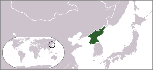
English: Locator map of North Korea. |
| ရက်စွဲ | |
| ရင်းမြစ် | ကိုယ်ပိုင်ဖန်တီးမှု |
| စာရေးသူ | Ksiom |
| အခြား ဗားရှင်းများ |
Derivative works of this file: Locator map of North Korea 1945-50.svg  |
လိုင်စင်သတ်မှတ်ခြင်း
| I, the copyright holder of this work, release this work into the public domain. This applies worldwide. In some countries this may not be legally possible; if so: အကျွန်ုပ်သည် ဤဖန်တီးမှုလက်ရာကို ဥပဒေအရလိုအပ်ခြင်းမရှိသည့် မည်သည့်အခြေအနေမျိုးတွက်မဆို၊ မည်သို့သော ရည်ရွယ်ချက်အတွက်မဆို ၎င်းကို မည်သူမဆို အသုံးပြုပိုင်ခွင့်အား ပေးအပ်သည်။ |
ဖိုင်မှတ်တမ်း
ဖိုင်ကို ယင်းနေ့စွဲ အတိုင်း မြင်နိုင်ရန် နေ့စွဲ/အချိန် တစ်ခုခုပေါ်တွင် ကလစ်နှိပ်ပါ။
| နေ့စွဲ/အချိန် | နမူနာပုံငယ် | မှတ်တမ်း ဒိုင်မန်းရှင်းများ | အသုံးပြုသူ | မှတ်ချက် | |
|---|---|---|---|---|---|
| ကာလပေါ် | ၁၇:၃၄၊ ၁၀ ဇူလိုင် ၂၀၀၉ | | ၂၅၀ × ၁၁၅ (၁.၁၈ MB) | Ksiom | revised version |
| ၂၀:၂၉၊ ၁၉ အောက်တိုဘာ ၂၀၀၈ |  | ၂၅၀ × ၁၁၅ (၁.၃၄ MB) | Ksiom | {{Information |Description={{en|1=Locator map of North Korea.}} |Source=Own work by uploader |Author=Ksiom |Date=2008-10-20 |Permission= |other_versions=Image:LocationNorthKorea.png }} <!--{{ImageUpload|full}}--> [[Category:Locator ma |
ဖိုင်သုံးစွဲမှု
အောက်ပါ စာမျက်နှာ သည် ဤဖိုင်ကို အသုံးပြုထားသည်:
ဂလိုဘယ် ဖိုင်သုံးစွဲမှု
အောက်ပါ အခြားဝီကီများတွင် ဤဖိုင်ကို အသုံးပြုထားသည်-
- as.wikipedia.org တွင် အသုံးပြုမှု
- az.wikipedia.org တွင် အသုံးပြုမှု
- bg.wikipedia.org တွင် အသုံးပြုမှု
- blk.wiktionary.org တွင် အသုံးပြုမှု
- bn.wikipedia.org တွင် အသုံးပြုမှု
- ca.wikipedia.org တွင် အသုံးပြုမှု
- de.wikipedia.org တွင် အသုံးပြုမှု
- de.wikinews.org တွင် အသုံးပြုမှု
- el.wikinews.org တွင် အသုံးပြုမှု
- Ο ηγέτης της Βόρειας Κορέας ανήγγειλε ειρήνη με τη Νότιο Κορέα
- Πρότυπο:ΒόρειαΚορέα
- Τεχνητή σεισμική δόνηση στη Βόρεια Κορέα
- Η Βόρεια Κορέα ετοιμάζει για νέες πυρηνικές δοκιμές
- Οι προϋποθέσεις που έθεσε η Βόρεια Κορέα για την έναρξη συνομιλιών
- Σε εκτόξευση πυραύλου από υποβρύχιο προχώρησε η Βόρεια Κορέα
- Η Βόρεια Κορέα γιορτάζει την 105η επέτειο της γέννησης του Κιμ Ιλ Σουνγκ
- Εκτόξευση πυραύλου από τη Βόρεια Κορέα
- Η Ρωσία χρησιμοποίησε το δικαίωμα αρνησικυρίας για να αποτρέψει ψήφισμα του ΟΗΕ κατά της Βορείου Κορέας
- Χαμηλώνει η ένταση στην Κορεατική Χερσόνησο
- Καταδίκη της Βορείου Κορέας από το Συμβούλιο Ασφαλείας του ΟΗΕ
- en.wikipedia.org တွင် အသုံးပြုမှု
- es.wikipedia.org တွင် အသုံးပြုမှု
- fa.wikipedia.org တွင် အသုံးပြုမှု
- fa.wikinews.org တွင် အသုံးပြုမှု
- fiu-vro.wikipedia.org တွင် အသုံးပြုမှု
- fr.wikinews.org တွင် အသုံးပြုမှု
- fr.wiktionary.org တွင် အသုံးပြုမှု
- gu.wikipedia.org တွင် အသုံးပြုမှု
- hif.wikipedia.org တွင် အသုံးပြုမှု
- id.wikipedia.org တွင် အသုံးပြုမှု
- it.wikivoyage.org တွင် အသုံးပြုမှု
- jam.wikipedia.org တွင် အသုံးပြုမှု
- ja.wikipedia.org တွင် အသုံးပြုမှု
- ja.wikinews.org တွင် အသုံးပြုမှု
- ja.wiktionary.org တွင် အသုံးပြုမှု
- ko.wikipedia.org တွင် အသုံးပြုမှု
- ko.wiktionary.org တွင် အသုံးပြုမှု
- kv.wikipedia.org တွင် အသုံးပြုမှု
- lo.wikipedia.org တွင် အသုံးပြုမှု
- mai.wikipedia.org တွင် အသုံးပြုမှု
ဤဖိုင်ကို အခြားနေရာများတွင် အသုံးပြုထားမှုများအား ကြည့်ရှုရန်။